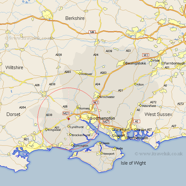
Hampshire Map Showing Location of Cadnam
Population: 1802
Area Size (ha): 84
District: New Forest
Easting: 429287 Northing: 113170
Latitude: 50.92 Longitude: -1.58
 = Cadnam
Area Size (ha): 84
District: New Forest
Easting: 429287 Northing: 113170
Latitude: 50.92 Longitude: -1.58
= Cadnam
This Cadnam map below is supplied by Google. Use the tools in the top left corner to zoom into street level or zoom out for a road map, you may also need to zoom in to see Cadnam on the map. Click and drag the map to move around. If the map fails to load try and refresh your browser or zoom in or out (+ or -).
Update - it seems Google no longer allow people to use their maps for free! This Cadnam map sometimes loads and sometimes gives a error. I am working on a solution.
Closest 30 Towns or Cities to Cadnam (Population over 500)
Bramshaw 2.98km Minstead 3.89km West Wellow 5.56km Lyndhurst 5.56km Totton 7.01km Eling 7.25km Sherfield English 7.4km Romsey 9.43km Hale 11.15km Marchwood 11.15km Brockenhurst 11.18km Dibden 11.9km Chilworth 12.25km Southampton 12.86km Burley 13.81km Hythe 14.01km Itchen 14.15km Michlemersh 14.22km Michelmersh 14.22km Ibsley 14.51km Bewley 14.53km Beaulieu 14.53km Sway 14.88km Fordingbridge 15.3km Ringwood 15.87km Sandleheath 16.78km Hursley 16.98km Boldre 17.05km Eastleigh 17.27km West End 17.52km