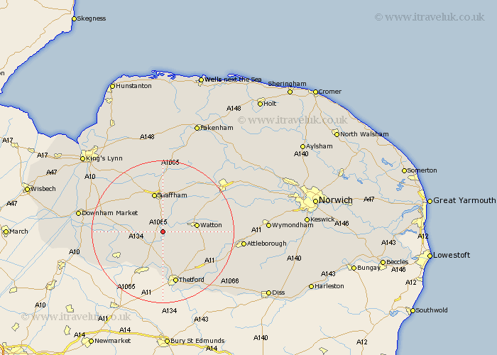
Norfolk Map Showing Location of Bodney
District: Breckland
Easting: 583041 Northing: 298148
Latitude: 52.55 Longitude: 0.7
 = Bodney
Easting: 583041 Northing: 298148
Latitude: 52.55 Longitude: 0.7
= Bodney
This Bodney map below is supplied by Google. Use the tools in the top left corner to zoom into street level or zoom out for a road map, you may also need to zoom in to see Bodney on the map. Click and drag the map to move around. If the map fails to load try and refresh your browser or zoom in or out (+ or -).
Update - it seems Google no longer allow people to use their maps for free! This Bodney map sometimes loads and sometimes gives a error. I am working on a solution.
Closest 30 Towns or Cities to Bodney (Population over 500)
Mundford 6.51km Northwold 6.76km Ashill 8.75km Watton 9.2km Methwold 10.8km Griston 11.27km Swaffham 11.35km Necton 12.46km Weeting 12.47km Stoke Ferry 12.53km Carbrooke 12.93km Carbooke 12.93km Palgrave 13.17km Great Palgrave 13.17km Feltwell 13.5km Hockham 13.59km Rockland 14.77km Rockland Saint Peter 14.77km Rockland St Peter 14.77km Rockland St. Peter 14.77km Marham 15.04km Hockwold cum Wilton 15.06km Hockwold 15.06km Wereham 15.11km Thetford 15.2km Shipdham 15.41km Castle Acre 16.72km Narborough 16.79km Great Ellingham 18.13km Shouldham 18.38km