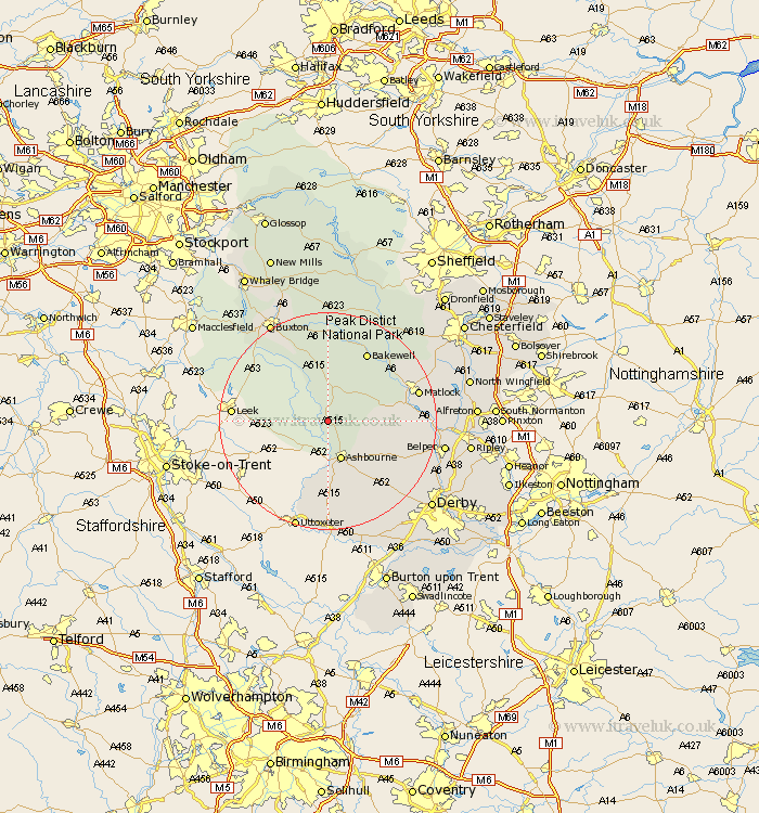
Derbyshire Map Showing Location of Alsop En Le Dale
District: Derbyshire Dales
Easting: 415627 Northing: 354067
Latitude: 53.08 Longitude: -1.77
 = Alsop En Le Dale
Easting: 415627 Northing: 354067
Latitude: 53.08 Longitude: -1.77
= Alsop En Le Dale
This Alsop En Le Dale map below is supplied by Google. Use the tools in the top left corner to zoom into street level or zoom out for a road map, you may also need to zoom in to see Alsop En Le Dale on the map. Click and drag the map to move around. If the map fails to load try and refresh your browser or zoom in or out (+ or -).
Update - it seems Google no longer allow people to use their maps for free! This Alsop En Le Dale map sometimes loads and sometimes gives a error. I am working on a solution.
Closest 30 Towns or Cities to Alsop En Le Dale (Population over 500)
Ashbourne 7.73km Brassington 7.79km Clifton 9.33km Winster 9.57km Middleton 9.86km Youlgreave 10.28km Bonsall 12.79km Wirksworth 13.36km Cromford 13.48km Darley Dale 14.48km Bakewell 14.59km Matlock Bath 14.63km Matlock 16.54km Longstone 17.26km Great Longstone 17.26km Tansley 17.59km Brailsford 17.9km Crich 18.92km Ambergate 19.29km Ambergate Junction Station 19.29km Baslow 19.45km Tideswell 20.39km Doveridge 20.66km Belper 20.8km Ashover 21.06km Buxton 21.06km Kirk Langley 21.38km Stoney Middleton 21.83km Stony Middleton 21.83km Heage 21.88km