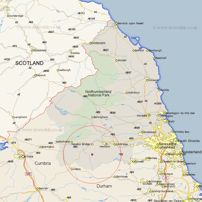
Northumberland Map Showing Location of Allendale Town
District: Tynedale
Easting: 385038 Northing: 556175
Latitude: 54.9 Longitude: -2.23
 = Allendale Town
Easting: 385038 Northing: 556175
Latitude: 54.9 Longitude: -2.23
= Allendale Town
This Allendale Town map below is supplied by Google. Use the tools in the top left corner to zoom into street level or zoom out for a road map, you may also need to zoom in to see Allendale Town on the map. Click and drag the map to move around. If the map fails to load try and refresh your browser or zoom in or out (+ or -).
Update - it seems Google no longer allow people to use their maps for free! This Allendale Town map sometimes loads and sometimes gives a error. I am working on a solution.
Closest 30 Towns or Cities to Allendale Town (Population over 500)
Haydon Bridge 7.42km Warden 11.25km Hexham 11.29km Newbrough 11.57km Acomb 12.58km Slaley 12.79km Sandhoe 14.93km Corbridge 15.7km Haltwhistle 15.78km Humshaugh 16.14km Chollerton 17.09km Challerton 17.09km Riding 17.44km Ridingmill 17.44km Wark 18.57km Stocksfield 20.57km Ovingham 24.57km Prudhoe 25.12km Wylam 25.59km Stamfordham 27.7km Bellingham 27.8km Newburn 32.79km Ponteland 35.07km Otterburn 35.47km Woolsington 37.44km Dinnington 38.86km Gosforth 40.92km Newcastle-on-Tyne 41.13km Newcastle on Tyne 41.13km Newcastle upon Tyne 41.13km