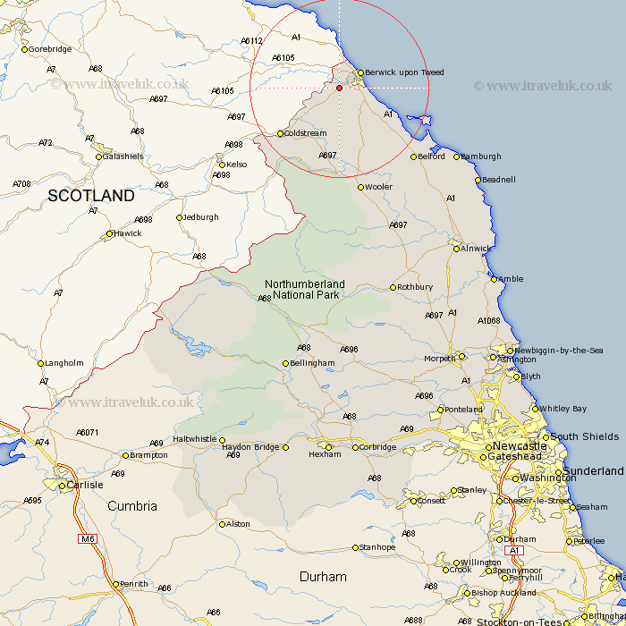
Northumberland Map Showing Location of West Ord
District: Berwick-upon-Tweed
Easting: 395815 Northing: 650736
Latitude: 55.75 Longitude: -2.07
 = West Ord
Easting: 395815 Northing: 650736
Latitude: 55.75 Longitude: -2.07
= West Ord
This West Ord map below is supplied by Google. Use the tools in the top left corner to zoom into street level or zoom out for a road map, you may also need to zoom in to see West Ord on the map. Click and drag the map to move around. If the map fails to load try and refresh your browser or zoom in or out (+ or -).
Update - it seems Google no longer allow people to use their maps for free! This West Ord map sometimes loads and sometimes gives a error. I am working on a solution.
Closest 30 Towns or Cities to West Ord (Population over 500)
East Ord 3.13km Ord 3.13km Berwick on Tweed 5.58km Berwick upon Tweed 5.58km Berwick-Upon-Tweed 5.58km Berwick 5.58km Berwick-upon-Tweed 5.58km Berwick-on-Tweed 5.58km Norham 6.4km Ancroft 6.95km Lowick 14.41km Belford 22.19km Wooler 24.45km North Sunderland 32.33km Beadnell 35.13km Embleton 40.96km Alnwick 45.23km Almwick 45.23km Alnmouth 48.74km Shilbottle 48.97km Rothbury 49.31km Lesbury 49.63km Lisburg 49.63km Warkworth 52.72km Swarland 54.26km Longframlington 54.87km Amble 55.42km Felton 56.8km East Thirston 57.23km Thirston 57.23km