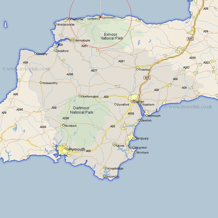
Devon Map Showing Location of Lynmouth
District: North Devon
Easting: 273136 Northing: 148010
Latitude: 51.23 Longitude: -3.82
 = Lynmouth
Easting: 273136 Northing: 148010
Latitude: 51.23 Longitude: -3.82
= Lynmouth
This Lynmouth map below is supplied by Google. Use the tools in the top left corner to zoom into street level or zoom out for a road map, you may also need to zoom in to see Lynmouth on the map. Click and drag the map to move around. If the map fails to load try and refresh your browser or zoom in or out (+ or -).
Update - it seems Google no longer allow people to use their maps for free! This Lynmouth map sometimes loads and sometimes gives a error. I am working on a solution.
Closest 30 Towns or Cities to Lynmouth (Population over 500)
Lynton 1.6km Linton 1.6km Bratton Fleming 15.36km Combe Martin 15.38km Berrynarbor 17.66km North Molton 19.68km Iltracombe 20.92km Ilfracombe 20.92km West Down 21.94km Marwood 22.25km Swimbridge 22.26km Barnstaple 22.78km South Molton 23.38km Chittlehampton 25.13km Tawstock 25.51km Mortehoe 27.14km Morthoe 27.14km Fremington 27.46km Georgeham 28.67km Braunton 29.19km Instow 31.34km High Bickington 31.61km Appledore 33.18km Burrington 33.92km Barrington 33.92km Chulmleigh 34.64km Witheridge 35.17km Northam 35.23km Bampton 35.69km Chawleigh 36.34km