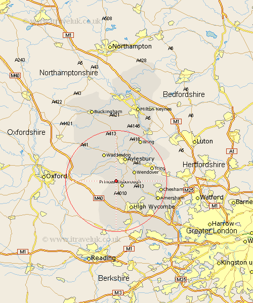
Buckinghamshire Map Showing Location of Longwick
Population: 1267
District: Wycombe
Easting: 479407 Northing: 204519
Latitude: 51.73 Longitude: -0.85
 = Longwick
District: Wycombe
Easting: 479407 Northing: 204519
Latitude: 51.73 Longitude: -0.85
= Longwick
This Longwick map below is supplied by Google. Use the tools in the top left corner to zoom into street level or zoom out for a road map, you may also need to zoom in to see Longwick on the map. Click and drag the map to move around. If the map fails to load try and refresh your browser or zoom in or out (+ or -).
Update - it seems Google no longer allow people to use their maps for free! This Longwick map sometimes loads and sometimes gives a error. I am working on a solution.
Closest 30 Towns or Cities to Longwick (Population over 500)
Bledlow 2.17km Princes Risborough 2.95km Kimble 3.44km Great Kimble 3.44km Ellesborough 4.95km Radnage 5.68km Haddenham 5.9km Cuddington 7.21km Stoke Mandeville 7.21km Stone 7.42km Wendover 7.82km Chearsley 7.82km Weston Turville 8.85km Prestwood 8.85km Halton 9.77km Stokenchurch 9.88km Bradenham 9.88km Aylesbury 9.89km Long Crendon 9.9km Great Missenden 10.98km Lee 11.63km West Wycombe 11.64km Buckland 11.8km Aston Clinton 11.8km Waddesdon 12.03km Hughenden 12.27km High Wycombe 12.52km Chepping 12.52km Wycombe 12.52km Lane End 13.02km