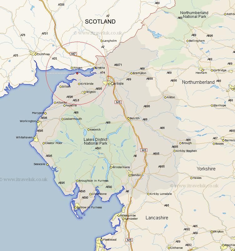
Cumbria Map Showing Location of Bowness On Solway
Population: 1221
District: Allerdale
Easting: 322084 Northing: 562391
Latitude: 54.95 Longitude: -3.22
 = Bowness On Solway
District: Allerdale
Easting: 322084 Northing: 562391
Latitude: 54.95 Longitude: -3.22
= Bowness On Solway
This Bowness On Solway map below is supplied by Google. Use the tools in the top left corner to zoom into street level or zoom out for a road map, you may also need to zoom in to see Bowness On Solway on the map. Click and drag the map to move around. If the map fails to load try and refresh your browser or zoom in or out (+ or -).
Update - it seems Google no longer allow people to use their maps for free! This Bowness On Solway map sometimes loads and sometimes gives a error. I am working on a solution.
Closest 30 Towns or Cities to Bowness On Solway (Population over 500)
Kirkbride 7.49km Burgh-by-Sands 11.27km Burgh 11.27km Burgh by Sands 11.27km Silloth 13.33km Wigton 13.66km Rockcliffe 15.02km Rockcliff 15.02km Thursby 16.79km Longtown 16.9km Bromfield 16.98km Stanwix 18.94km Westward 19.29km Carlisle 19.57km Dalston 19.78km Aspatria 23.46km Caldbeck 26.35km Wetheral 27.2km Hesket Newmarket 27.29km Crosscanonby 27.8km Irthington 28.8km Hayton 30.33km Brampton 30.86km Dearham 31.07km Bridekirk 31.17km Cockermouth 32.64km Maryport 33.2km Broughton Moor 33.7km Farlam 34.27km Ainstable 35.13km