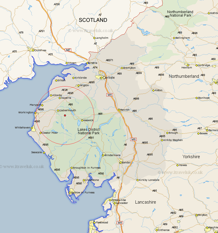
Cumbria Map Showing Location of Embleton Station
Population: 297
District: Allerdale
Easting: 317170 Northing: 527232
Latitude: 54.63 Longitude: -3.28
 = Embleton Station
District: Allerdale
Easting: 317170 Northing: 527232
Latitude: 54.63 Longitude: -3.28
= Embleton Station
This Embleton Station map below is supplied by Google. Use the tools in the top left corner to zoom into street level or zoom out for a road map, you may also need to zoom in to see Embleton Station on the map. Click and drag the map to move around. If the map fails to load try and refresh your browser or zoom in or out (+ or -).
Update - it seems Google no longer allow people to use their maps for free! This Embleton Station map sometimes loads and sometimes gives a error. I am working on a solution.
Closest 30 Towns or Cities to Embleton Station (Population over 500)
Cockermouth 5.67km Bridekirk 7.72km Brigham 8.78km Dean 10.34km Lamplugh 10.55km Koswick 11.35km Keswick 11.35km Dearham 12.17km Broughton Moor 13.04km Aspatria 13.37km Crosscanonby 14.72km Maryport 15.78km Flimby 16.01km Frizington 17.02km Distington 17.03km Workington 18.33km Bromfield 18.57km Caldbeck 18.67km Westward 19.26km Cleator Moor 19.86km Lowca 20.1km Hesket Newmarket 20.43km Parton 20.69km Whitehaven 22.41km Wigton 23.83km Egremont 23.87km St. Bega 26.11km Saint Bega 26.11km Saint Bees 26.11km St Bega 26.11km