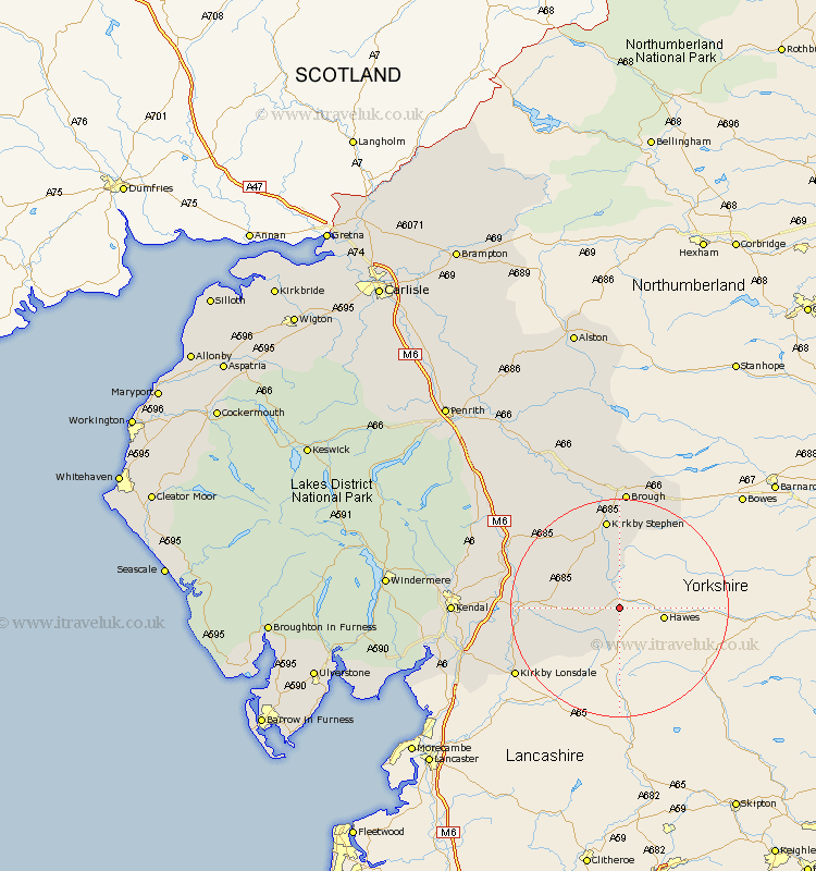
Cumbria Map Showing Location of Garsdale
Population: 202
District: South Lakeland
Easting: 379402 Northing: 491297
Latitude: 54.32 Longitude: -2.32
 = Garsdale
District: South Lakeland
Easting: 379402 Northing: 491297
Latitude: 54.32 Longitude: -2.32
= Garsdale
This Garsdale map below is supplied by Google. Use the tools in the top left corner to zoom into street level or zoom out for a road map, you may also need to zoom in to see Garsdale on the map. Click and drag the map to move around. If the map fails to load try and refresh your browser or zoom in or out (+ or -).
Update - it seems Google no longer allow people to use their maps for free! This Garsdale map sometimes loads and sometimes gives a error. I am working on a solution.
Closest 30 Towns or Cities to Garsdale (Population over 500)
Dent 10.29km Ravenstonedale 12.87km Milnthorpe 12.97km Sedbergh 12.97km Millthrop 12.97km Kirkby Stephen 16.82km Tebay 20.54km Kirkby Londsdale 21.64km Kirkby Lonsdale 21.64km Brough 22.27km Orton 23.24km Natland 27.29km Kendal 28.11km Kendall 28.11km Crosby Ravensworth 28.15km Appleby 29.81km Holme 29.92km Heversham 30.65km Levens 31.19km Milnthorpe 31.27km Shap 31.74km Beetham 31.98km Staveley 32.88km Long Marston 34.05km Long Marton 34.05km Kirkby Thore 36.61km Arnside 36.7km Windermere 39.29km Culgaith 41.33km Ambleside 43.55km