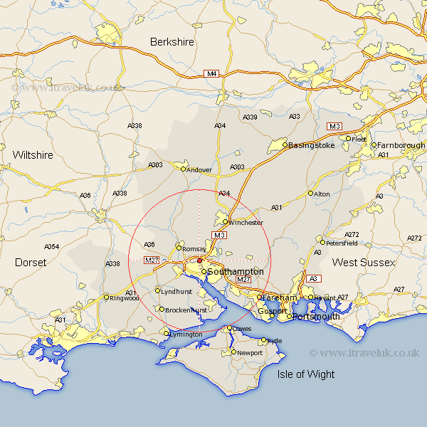
Hampshire Map Showing Location of Chilworth
Population: 1928
District: Test Valley
Easting: 440971 Northing: 116952
Latitude: 50.95 Longitude: -1.42
 = Chilworth
District: Test Valley
Easting: 440971 Northing: 116952
Latitude: 50.95 Longitude: -1.42
= Chilworth
This Chilworth map below is supplied by Google. Use the tools in the top left corner to zoom into street level or zoom out for a road map, you may also need to zoom in to see Chilworth on the map. Click and drag the map to move around. If the map fails to load try and refresh your browser or zoom in or out (+ or -).
Update - it seems Google no longer allow people to use their maps for free! This Chilworth map sometimes loads and sometimes gives a error. I am working on a solution.
Closest 30 Towns or Cities to Chilworth (Population over 500)
Chilworth 0km Southampton 3.53km Eastleigh 5.03km Totton 5.96km Itchen 6.03km Bishopstoke 6.13km Romsey 6.91km West End 6.91km Otterbourne 7.26km Eling 7.26km Marchwood 7.5km Hursley 7.51km Hythe 9.34km Dibden 9.34km Compton 9.44km Twyford 10.2km Ashurst 10.78km Michlemersh 10.95km Michelmersh 10.95km Netley 10.95km Netley Marsh 10.95km Botley 11.15km Durley 11.68km West Wellow 11.82km Owslebury 11.88km Sherfield English 12.24km Cadnam 12.25km Curbridge 12.25km Curdridge 12.25km Bursledon 12.36km