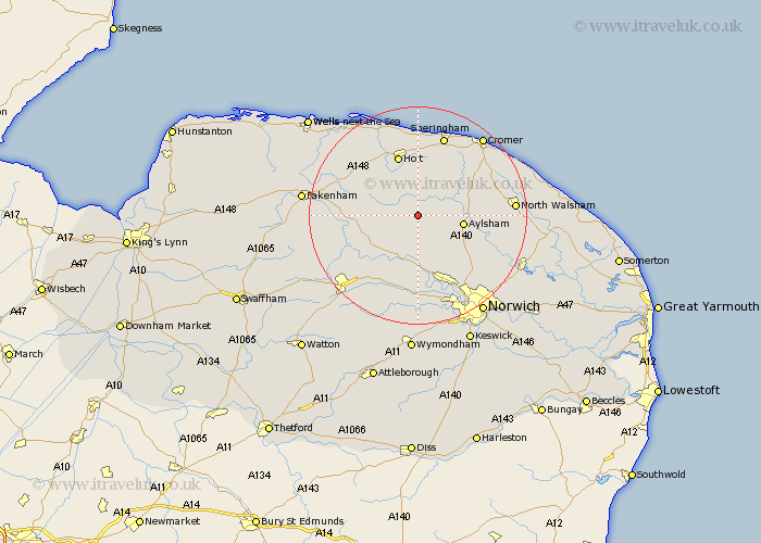
Norfolk Map Showing Location of Sall
Population: 50
District: Broadland
Easting: 611200 Northing: 327132
Latitude: 52.8 Longitude: 1.13
 = Sall
District: Broadland
Easting: 611200 Northing: 327132
Latitude: 52.8 Longitude: 1.13
= Sall
This Sall map below is supplied by Google. Use the tools in the top left corner to zoom into street level or zoom out for a road map, you may also need to zoom in to see Sall on the map. Click and drag the map to move around. If the map fails to load try and refresh your browser or zoom in or out (+ or -).
Update - it seems Google no longer allow people to use their maps for free! This Sall map sometimes loads and sometimes gives a error. I am working on a solution.
Closest 30 Towns or Cities to Sall (Population over 500)
Corpusty 1.86km Cawston 4.33km Reepham 5.67km Briston 7.14km Witchingham 7.5km Hindolveston 8.06km Foulsham 8.06km Foulham 8.06km Aylsham 8.06km Erpingham 8.67km Marsham 8.68km Mellon Constable 8.72km Melton Constable 8.72km Bawdeswell 10.01km Lyng 10.29km Hevingham 10.55km Holt 11.62km Felmingham 13.45km North Elmham 14.39km Roughton 14.53km Hainford 14.55km Haynford 14.55km Little Hautbois 14.56km Lamas Little Hautbois 14.56km Lammas 14.56km Ryburgh 14.68km Great Ryburgh 14.68km Weybourne 14.86km Horsford 15.17km Taverham 15.2km