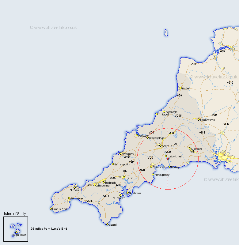
Cornwall Map Showing Location of St Winnow
Population: 304
District: Caradon
Easting: 211627 Northing: 57137
Latitude: 50.38 Longitude: -4.65
 = St Winnow
District: Caradon
Easting: 211627 Northing: 57137
Latitude: 50.38 Longitude: -4.65
= St Winnow
This St Winnow map below is supplied by Google. Use the tools in the top left corner to zoom into street level or zoom out for a road map, you may also need to zoom in to see St Winnow on the map. Click and drag the map to move around. If the map fails to load try and refresh your browser or zoom in or out (+ or -).
Update - it seems Google no longer allow people to use their maps for free! This St Winnow map sometimes loads and sometimes gives a error. I am working on a solution.
Closest 30 Towns or Cities to St Winnow (Population over 500)
Lostwithiel 2.2km Tywardreath 4.39km Saint Blazey 5.08km St. Blazey 5.08km St Blazey 5.08km Fowey 5.69km Lanreath 5.91km Par 6.01km Lanteglos 6.04km Lansallos 6.19km Pelynt 8.48km Bodmin 10.41km Stenalees 10.63km Bugle 10.64km Lanivet 11.11km Cardingham 11.12km Cardinham 11.12km Duloe 11.82km Saint Austell 12.01km St. Austell 12.01km St Austell 12.01km Dobwalls 12.01km Roche 13.13km Morval 14.18km West Looe 14.39km Looe 14.39km Mevagissey 14.6km Mevegissey 14.6km Blisland 15.02km Liskeard 15.99km