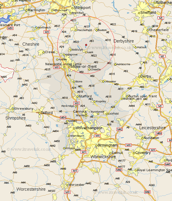
Staffordshire Map Showing Location of Meerbrook
District: Staffordshire Moorlands
Easting: 398885 Northing: 361461
Latitude: 53.15 Longitude: -2.02
 = Meerbrook
Easting: 398885 Northing: 361461
Latitude: 53.15 Longitude: -2.02
= Meerbrook
This Meerbrook map below is supplied by Google. Use the tools in the top left corner to zoom into street level or zoom out for a road map, you may also need to zoom in to see Meerbrook on the map. Click and drag the map to move around. If the map fails to load try and refresh your browser or zoom in or out (+ or -).
Update - it seems Google no longer allow people to use their maps for free! This Meerbrook map sometimes loads and sometimes gives a error. I am working on a solution.
Closest 30 Towns or Cities to Meerbrook (Population over 500)
Leek 5.56km Horton 5.79km Endon 9.98km Biddulph 10.67km Cheddleton 11.17km Ipstones 13.4km Kingsley 14.99km Kidsgrove 16.25km Waterhouses 16.39km Oakamoor 17.97km Cheadle 18.67km Caverswall 18.84km Stoke upon Trent 20.05km Stoke 20.05km Stoke-upon-Trent 20.05km Stoke on Trent 20.05km Stoke-on-Trent 20.05km Draycott in the Moors 20.41km Draycott 20.41km Audley 21.94km Newcastle-under-Lyme 22.08km Newcastle under Lyme 22.08km Alton 22.24km Fulford 22.49km Silverdale 23.17km Denstone 23.23km Denston 23.23km Mayfield 23.6km Barlaston 24.39km Keele 24.4km