Cornwall Map Showing Location of Little Petherick
District: North Cornwall
Easting: 192075 Northing: 72721
Latitude: 50.52 Longitude: -4.93
 = Little Petherick
Easting: 192075 Northing: 72721
Latitude: 50.52 Longitude: -4.93
= Little Petherick
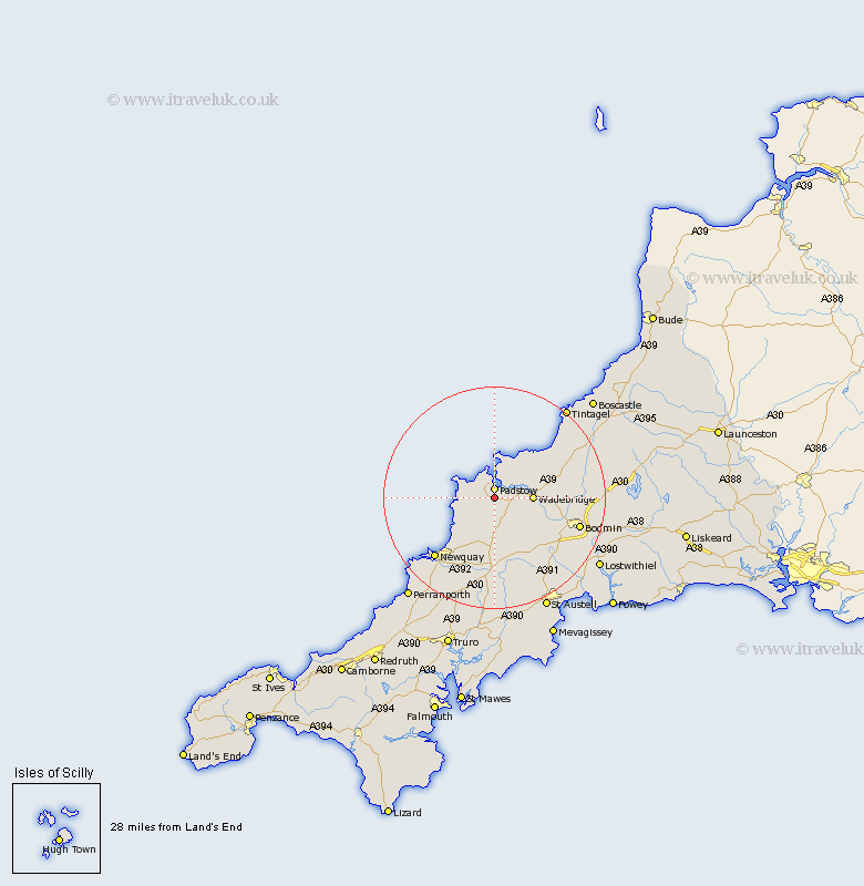
This Little Petherick map below is supplied by Google. Use the tools in the top left corner to zoom into street level or zoom out for a road map, you may also need to zoom in to see Little Petherick on the map. Click and drag the map to move around. If the map fails to load try and refresh your browser or zoom in or out (+ or -).
Update - it seems Google no longer allow people to use their maps for free! This Little Petherick map sometimes loads and sometimes gives a error. I am working on a solution.
Closest 30 Towns or Cities to Little Petherick (Population over 500)
Padstow 1.85km St Issey 2.2km St. Issey 2.2km Saint Issey 2.2km Saint Merryn 2.36km St. Merryn 2.36km St Merryn 2.36km Wadebridge 7.07km St. Columb Major 9.27km St Columb Major 9.27km St Columb 9.27km Saint Columb 9.27km Saint Columb Major 9.27km St. Columb 9.27km Lanivet 13.93km Roche 14.78km St. Denis 15.25km St Denis 15.25km Saint Dennis 15.25km St. Dennis 15.25km Saint Denis 15.25km St Dennis 15.25km Newquay 15.37km Bodmin 16.3km Stenalees 17.19km Bugle 17.58km Blisland 17.68km Crantock 18.35km Cubert 19.71km Saint Blazey 20.09km