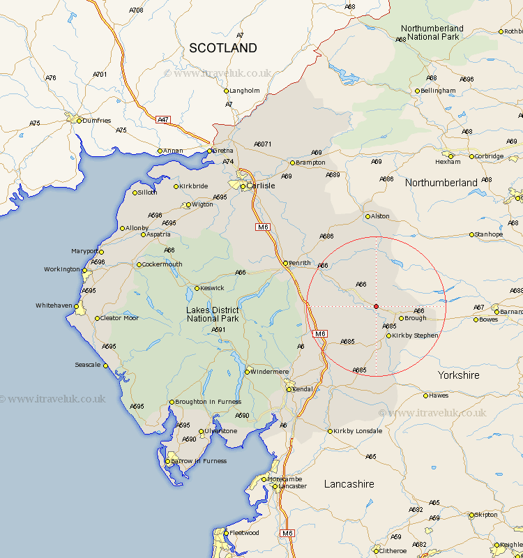
Cumbria Map Showing Location of Crossdale
District: Eden
Easting: 374129 Northing: 517281
Latitude: 54.55 Longitude: -2.4
 = Crossdale
Easting: 374129 Northing: 517281
Latitude: 54.55 Longitude: -2.4
= Crossdale
This Crossdale map below is supplied by Google. Use the tools in the top left corner to zoom into street level or zoom out for a road map, you may also need to zoom in to see Crossdale on the map. Click and drag the map to move around. If the map fails to load try and refresh your browser or zoom in or out (+ or -).
Update - it seems Google no longer allow people to use their maps for free! This Crossdale map sometimes loads and sometimes gives a error. I am working on a solution.
Closest 30 Towns or Cities to Crossdale (Population over 500)
Appleby 5.68km Brough 7.44km Long Marston 9.35km Long Marton 9.35km Kirkby Stephen 9.81km Kirkby Thore 12.18km Crosby Ravensworth 12.39km Orton 14.2km Ravenstonedale 14.86km Culgaith 17.02km Shap 17.6km Tebay 18.97km Langwathby 22.68km Millthrop 27.02km Sedbergh 27.02km Milnthorpe 27.02km Lasonby 28.07km Lazonby 28.07km Dacre 28.89km Kirkoswald 30.87km Dent 31.67km Greystoke 32.05km Staveley 33.78km Skelton 34.36km Kendall 34.43km Kendal 34.43km Ainstable 35.1km Natland 36.67km Windermere 39.12km Ambleside 39.49km