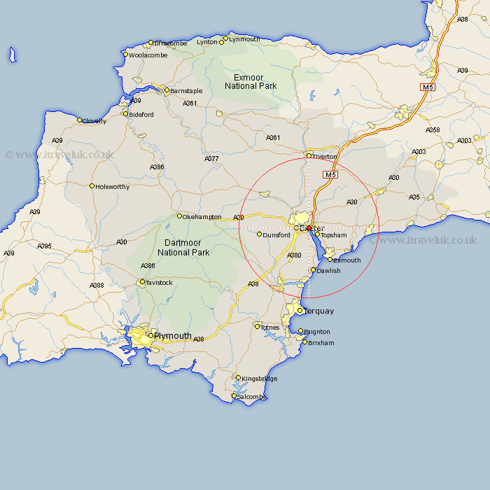
Devon Map Showing Location of Wear
District: East Devon
Easting: 295257 Northing: 90041
Latitude: 50.7 Longitude: -3.48
 = Wear
Easting: 295257 Northing: 90041
Latitude: 50.7 Longitude: -3.48
= Wear
This Wear map below is supplied by Google. Use the tools in the top left corner to zoom into street level or zoom out for a road map, you may also need to zoom in to see Wear on the map. Click and drag the map to move around. If the map fails to load try and refresh your browser or zoom in or out (+ or -).
Update - it seems Google no longer allow people to use their maps for free! This Wear map sometimes loads and sometimes gives a error. I am working on a solution.
Closest 30 Towns or Cities to Wear (Population over 500)
Exminster 1.86km Topsham 2.99km Exeter 3.52km Ide 5.87km Woodbury Road Station 6.16km Lympstone 7.28km Kenton 7.51km Stoke Canon 7.51km Broad Clyst 8.21km Aylesbeare 8.42km Rockbeare 8.97km Whitestone 9.01km Starcross 9.56km Holcombe Burnell 10.72km Newton St. Cyres 11.06km Newton Saint Cyres 11.06km Saint Cyres 11.06km St. Cyres 11.06km Newton St Cyres 11.06km St Cyres 11.06km Exmouth 11.29km Thorverton 11.66km Colaton Raleigh 11.89km Colyton Raleigh 11.89km Whimple 11.96km Budleigh Salterton 12.91km Newton Poppleford 12.91km Silverton 12.97km East Budleigh 12.99km Christow 12.99km