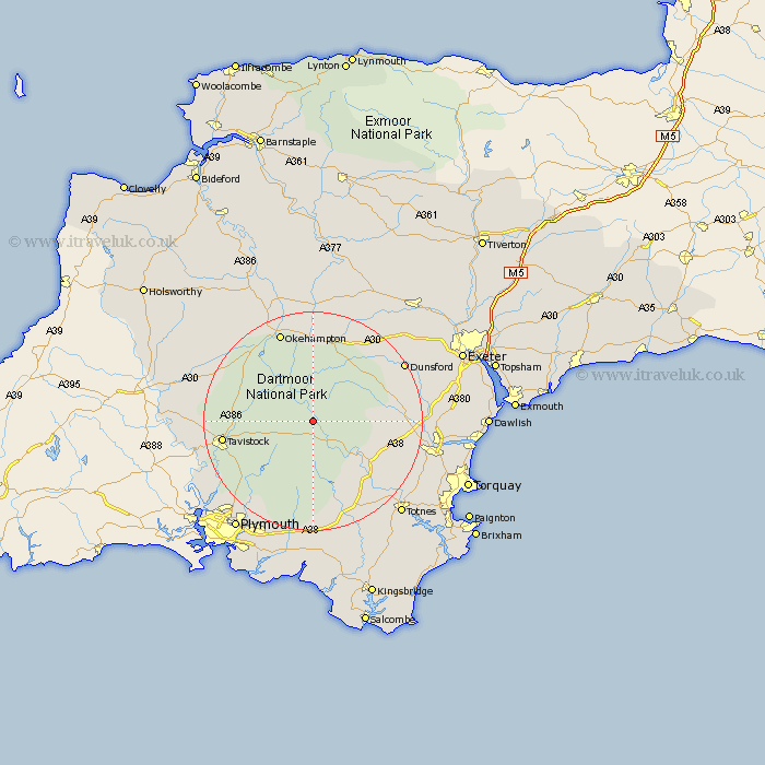
Devon Map Showing Location of Dartmoor Forest
Population: 1619
District: West Devon
Easting: 264324 Northing: 77770
Latitude: 50.58 Longitude: -3.92
 = Dartmoor Forest
District: West Devon
Easting: 264324 Northing: 77770
Latitude: 50.58 Longitude: -3.92
= Dartmoor Forest
This Dartmoor Forest map below is supplied by Google. Use the tools in the top left corner to zoom into street level or zoom out for a road map, you may also need to zoom in to see Dartmoor Forest on the map. Click and drag the map to move around. If the map fails to load try and refresh your browser or zoom in or out (+ or -).
Update - it seems Google no longer allow people to use their maps for free! This Dartmoor Forest map sometimes loads and sometimes gives a error. I am working on a solution.
Closest 30 Towns or Cities to Dartmoor Forest (Population over 500)
Widdecombe 8.44km Widecombe in the Moor 8.44km Chagford 12.58km Walkhampton 12.93km Ilsington 13.08km Moretonhampstead 13.9km Ashburton 13.91km Meavy 14.58km Buckfastleigh 14.58km Lustleigh 14.6km Horrabridge 15.93km Drewsteignton 16.03km Yelverton 16.2km Whitchurch 16.28km Whitechurch 16.28km Bovey Tracey 16.48km South Tawton 16.72km Tavistock 16.89km Bridestowe 17.05km Shaugh Prior 17.57km Okehampton 17.69km Brent 17.69km South Brent 17.69km Hennock 17.75km Buckland Monachorum 17.89km Bickleigh 18.23km Cornwood 18.86km Lamerton 18.92km Dunsford 19.86km Broadhempston 19.89km