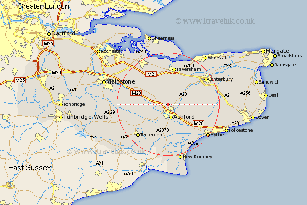
Kent Map Showing Location of Eastwell
Population: 119
District: Ashford
Easting: 600322 Northing: 146638
Latitude: 51.18 Longitude: 0.87
 = Eastwell
District: Ashford
Easting: 600322 Northing: 146638
Latitude: 51.18 Longitude: 0.87
= Eastwell
This Eastwell map below is supplied by Google. Use the tools in the top left corner to zoom into street level or zoom out for a road map, you may also need to zoom in to see Eastwell on the map. Click and drag the map to move around. If the map fails to load try and refresh your browser or zoom in or out (+ or -).
Update - it seems Google no longer allow people to use their maps for free! This Eastwell map sometimes loads and sometimes gives a error. I am working on a solution.
Closest 30 Towns or Cities to Eastwell (Population over 500)
Kennington 3.88km Wye 4.65km Charing 5km Hothfield 5.09km Ashford 5.68km Hinxhill 7.25km Pluckley 8.13km Chilham 8.91km Egerton 9.29km Kingsnorth 9.34km Shadoxhurst 9.9km Selling 9.91km Smeeth 10.17km Bethersden 10.17km Mersham 10.36km Brabourne 10.83km Doddington 11.6km Lenham 11.84km Aldington 12.55km Chartham 12.81km Ospringe 12.98km Orlestone 13.02km Sellindge 13.13km Sellinge 13.13km Petham 13.3km Dunkirk 13.77km Harrietsham 13.93km Stelling 13.94km Smarden 13.94km Linsted 14.21km