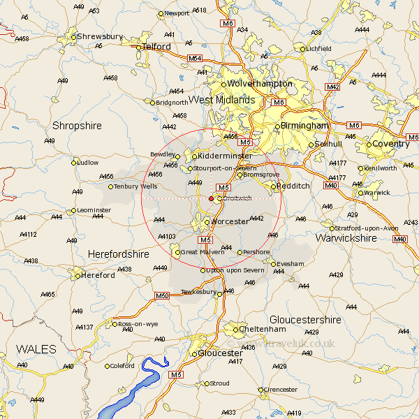
Worcestershire Map Showing Location of Westwood
Population: 63
District: Wychavon
Easting: 387490 Northing: 263230
Latitude: 52.27 Longitude: -2.18
 = Westwood
District: Wychavon
Easting: 387490 Northing: 263230
Latitude: 52.27 Longitude: -2.18
= Westwood
This Westwood map below is supplied by Google. Use the tools in the top left corner to zoom into street level or zoom out for a road map, you may also need to zoom in to see Westwood on the map. Click and drag the map to move around. If the map fails to load try and refresh your browser or zoom in or out (+ or -).
Update - it seems Google no longer allow people to use their maps for free! This Westwood map sometimes loads and sometimes gives a error. I am working on a solution.
Closest 30 Towns or Cities to Westwood (Population over 500)
Droitwich 2.27km Ombersley 3.4km Fernhill Heath 3.88km Holt 4.9km Grimley 5.86km Hallow 7.18km Worcester 7.5km Hartlebury 8.15km Crowle 8.7km Stoke Prior 8.76km Hanbury 9.07km Chaddesley Corbett 9.33km Astley 9.8km Bromsgrove 10.85km Stourport on Severn 10.86km Stourport 10.86km Stourport-on-Severn 10.86km Great Dodford 10.86km Dodford 10.86km Stone 11.18km Great Witley 11.49km Powick 12.01km Leigh 12.98km Abberley 13.01km Martley 13.02km Kidderminster 13.73km Feckenham 13.74km Peopleton 14.16km Lickey 14.35km Lickey End 14.35km