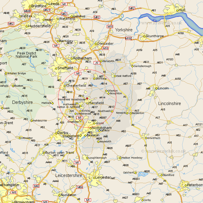
Nottinghamshire Map Showing Location of Mansfield Woodhouse
Population: 18003
Area Size (ha): 394
District: Mansfield
Easting: 453475 Northing: 363617
Latitude: 53.17 Longitude: -1.2
 = Mansfield Woodhouse
Area Size (ha): 394
District: Mansfield
Easting: 453475 Northing: 363617
Latitude: 53.17 Longitude: -1.2
= Mansfield Woodhouse
This Mansfield Woodhouse map below is supplied by Google. Use the tools in the top left corner to zoom into street level or zoom out for a road map, you may also need to zoom in to see Mansfield Woodhouse on the map. Click and drag the map to move around. If the map fails to load try and refresh your browser or zoom in or out (+ or -).
Update - it seems Google no longer allow people to use their maps for free! This Mansfield Woodhouse map sometimes loads and sometimes gives a error. I am working on a solution.
Closest 30 Towns or Cities to Mansfield Woodhouse (Population over 500)
Pleasley 3.33km Mansfield 3.71km Warsop 4.98km Clipstone 6.67km Sutton in Ashfield 7.12km Hucknall-under-Huthwaite 7.63km Hucknall 7.63km Hucknall under Huthwaite 7.63km Huthwaite 7.63km Rainworth 7.86km Edwinstowe 9.08km Kirkby 10.28km Kirkby in Ashfield 10.28km Blidworth 10.28km Newstead 11.17km Bilsthorpe 11.72km Papplewick 13.02km Farnsfield 13.37km Annesley 13.4km Ollerton 13.42km Selston 13.57km Underwood 13.8km Boughton 14.26km Worksop 15.47km Oxton 15.73km Walesby 16.22km Calverton 16.75km Claverton 16.75km Shireoaks 16.83km Greasley 17.26km