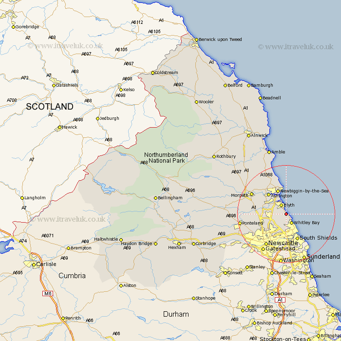
Northumberland Map Showing Location of Seaton Sluice
Population: 3240
Area Size (ha): 64
District: Blyth Valley
Easting: 432887 Northing: 577045
Latitude: 55.09 Longitude: -1.48
 = Seaton Sluice
Area Size (ha): 64
District: Blyth Valley
Easting: 432887 Northing: 577045
Latitude: 55.09 Longitude: -1.48
= Seaton Sluice
This Seaton Sluice map below is supplied by Google. Use the tools in the top left corner to zoom into street level or zoom out for a road map, you may also need to zoom in to see Seaton Sluice on the map. Click and drag the map to move around. If the map fails to load try and refresh your browser or zoom in or out (+ or -).
Update - it seems Google no longer allow people to use their maps for free! This Seaton Sluice map sometimes loads and sometimes gives a error. I am working on a solution.
Closest 30 Towns or Cities to Seaton Sluice (Population over 500)
Seaton Delaval 3.01km Blythe 4.21km Blyth 4.21km Whitley 4.45km Whitley Bay 4.45km Seghill 5.82km Cramlington 6.66km Dudley 6.95km Shiremoor 7.57km Tynemouth 7.69km Killingworth 7.91km Bedlington 8.19km North Shields 9.15km Newbiggin-by-the-Sea 10.52km Newbiggin by the Sea 10.52km Ashington 10.75km Longbenton 10.96km Long Benton 10.96km Wallsend on Tyne 11.62km Wallsend 11.62km Wallsend-on-Tyne 11.62km Stannington 11.67km South Shields 11.71km Hepscott 12.65km Gosforth 12.79km Pegswood 12.98km Dinnington 13.29km Lynemouth 14.53km Woolsington 14.85km Newcastle on Tyne 15.24km