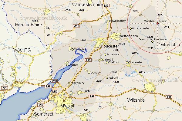
Gloucestershire Map Showing Location of Moreton In Marsh
Population: 1986
Area Size (ha): 91
District: Cotswold
Easting: 420600 Northing: 231742
Latitude: 51.98 Longitude: -1.7
 = Moreton In Marsh
Area Size (ha): 91
District: Cotswold
Easting: 420600 Northing: 231742
Latitude: 51.98 Longitude: -1.7
= Moreton In Marsh
This Moreton In Marsh map below is supplied by Google. Use the tools in the top left corner to zoom into street level or zoom out for a road map, you may also need to zoom in to see Moreton In Marsh on the map. Click and drag the map to move around. If the map fails to load try and refresh your browser or zoom in or out (+ or -).
Update - it seems Google no longer allow people to use their maps for free! This Moreton In Marsh map sometimes loads and sometimes gives a error. I am working on a solution.
Closest 30 Towns or Cities to Moreton In Marsh (Population over 500)
Moreton in Marsh 0km Moreton in the Marsh 0km Moreton-in-Marsh 0km Blockley 5.05km Stow-on-the-Wold 6.01km Stow on the Wold 6.01km Ebrington 7.76km Chipping Campden 7.96km Mickleton 12.02km Bledington 12.03km Bourton-on-the-Water 13.42km Bourton on the Water 13.42km Winchcomb 17.52km Winchcombe 17.52km Northleach 18.5km Dumbleton 18.63km Alderton 20.54km Andoversford 21.5km Withington 23.93km Southam 24.62km Chedworth 25.23km Bishops Cleeve 25.39km Bibury 27.15km Cheltenham 27.86km Swindon 27.97km Charlton Kings 28.29km Ashchurch 28.59km Leckhampton 29.31km Quenington 30.19km North Cerney 30.26km