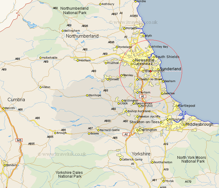
Durham Map Showing Location of South Hylton
District: Sunderland
Easting: 435266 Northing: 556289
Latitude: 54.9 Longitude: -1.45
 = South Hylton
Easting: 435266 Northing: 556289
Latitude: 54.9 Longitude: -1.45
= South Hylton
This South Hylton map below is supplied by Google. Use the tools in the top left corner to zoom into street level or zoom out for a road map, you may also need to zoom in to see South Hylton on the map. Click and drag the map to move around. If the map fails to load try and refresh your browser or zoom in or out (+ or -).
Update - it seems Google no longer allow people to use their maps for free! This South Hylton map sometimes loads and sometimes gives a error. I am working on a solution.
Closest 30 Towns or Cities to South Hylton (Population over 500)
Washington 4.26km Washington New Town 4.26km Sunderland 4.46km Boldon 5.66km West Boldon 5.66km Houghton le Spring 5.66km Birtley 7.69km Whitburn 7.88km Hebburn 8.55km Hebburn-on-Tyne 8.55km Hebburn on Tyne 8.55km Seaton 8.56km Jarrow 8.96km Jarrow on Tyne 8.96km Jarrow-on-Tyne 8.96km Marsden 9.13km Hetton le Hole 9.26km Chester-le-Street 9.31km Felling 9.32km Murton 9.51km Lamesley 9.77km West Rainton 9.8km Seaham Harbour 10.04km Seaham 10.04km Pelton 10.28km Ouston Moor 10.32km Ouston 10.32km Dalton le Dale 10.69km Dalton 10.69km Pittington 11.32km