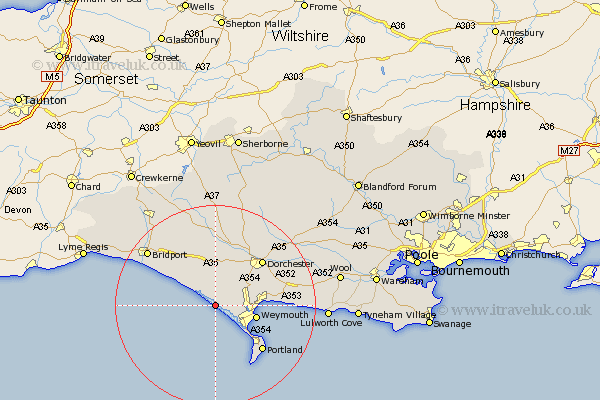
Dorset Map Showing Location of Chesil Bank
District: West Dorset
Easting: 359928 Northing: 81729
Latitude: 50.63 Longitude: -2.57
 = Chesil Bank
Easting: 359928 Northing: 81729
Latitude: 50.63 Longitude: -2.57
= Chesil Bank
This Chesil Bank map below is supplied by Google. Use the tools in the top left corner to zoom into street level or zoom out for a road map, you may also need to zoom in to see Chesil Bank on the map. Click and drag the map to move around. If the map fails to load try and refresh your browser or zoom in or out (+ or -).
Update - it seems Google no longer allow people to use their maps for free! This Chesil Bank map sometimes loads and sometimes gives a error. I am working on a solution.
Closest 30 Towns or Cities to Chesil Bank (Population over 500)
Portisham 3.71km Portesham 3.71km Abbotsbury 4.4km West Chickerel 5.05km Chickerell 5.05km Bincombe 8.43km Weymouth 8.63km Overcombe 9.51km Preston 10.74km Fortuneswell 12.39km Burton Bradstock 12.91km Dorchester 13.2km Isle of Portland 13.21km Portland 13.21km Island of Portland 13.21km Weston 13.28km Charminster 13.83km Easton 13.84km Broadmayne 14.07km Osmington 14.11km Upton 14.34km Maiden Newton 14.83km Loders 15.34km Bradpole 16.17km Bridport 17.4km Piddletrenthide 19.74km Puddletrenthide 19.74km Cerne Abbas 19.83km Chideock 19.91km Piddletown 20.03km