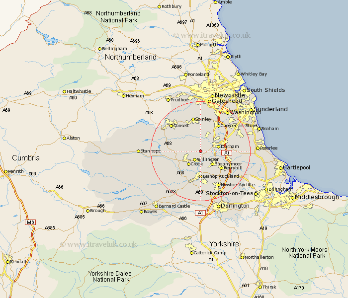
Durham Map Showing Location of Brandon And Byshottles
District: Durham
Easting: 421452 Northing: 539511
Latitude: 54.75 Longitude: -1.67
 = Brandon And Byshottles
Easting: 421452 Northing: 539511
Latitude: 54.75 Longitude: -1.67
= Brandon And Byshottles
This Brandon And Byshottles map below is supplied by Google. Use the tools in the top left corner to zoom into street level or zoom out for a road map, you may also need to zoom in to see Brandon And Byshottles on the map. Click and drag the map to move around. If the map fails to load try and refresh your browser or zoom in or out (+ or -).
Update - it seems Google no longer allow people to use their maps for free! This Brandon And Byshottles map sometimes loads and sometimes gives a error. I am working on a solution.
Closest 30 Towns or Cities to Brandon And Byshottles (Population over 500)
Brandon 3.21km Ushaw Moor 3.86km Willington 4.28km Esh 4.28km Langley Park 5.56km Witton Gilbert 5.96km Durham 6.68km Crook 7.02km Spennymoor 7.08km Cornsay 7.41km Sacriston 8.08km Lanchester 8.56km Shincliffe 8.76km Coundon 9.32km Bowburn 9.81km Tow Law 9.81km Ferryhill 10.54km Bishop Auckland 11.12km Cornforth 11.12km West Cornforth 11.12km Coxhoe 11.32km Edmondsley 11.32km Sherburn 11.91km Annfield Plain 11.91km Etherley 12.34km High Etherley 12.34km Chester-le-Street 12.84km Pittington 13.01km West Rainton 13.01km Shildon 13.02km