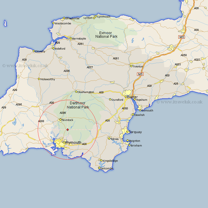
Devon Map Showing Location of Yelverton
Population: 3493
Area Size (ha): 122
District: West Devon
Easting: 252216 Northing: 66971
Latitude: 50.48 Longitude: -4.08
 = Yelverton
Area Size (ha): 122
District: West Devon
Easting: 252216 Northing: 66971
Latitude: 50.48 Longitude: -4.08
= Yelverton
This Yelverton map below is supplied by Google. Use the tools in the top left corner to zoom into street level or zoom out for a road map, you may also need to zoom in to see Yelverton on the map. Click and drag the map to move around. If the map fails to load try and refresh your browser or zoom in or out (+ or -).
Update - it seems Google no longer allow people to use their maps for free! This Yelverton map sometimes loads and sometimes gives a error. I am working on a solution.
Closest 30 Towns or Cities to Yelverton (Population over 500)
Horrabridge 2.2km Meavy 2.36km Bickleigh 3.89km Walkhampton 3.9km Buckland Monachorum 3.99km Shaugh Prior 4.39km Whitchurch 6.59km Whitechurch 6.59km Tavistock 8.79km Plymouth 9.56km Gunnislake 10.95km Cornwood 11.09km Lamerton 11.66km Brixton 15.24km Dartmoor Forest 16.2km Ivybridge 16.21km Yealmpton 16.43km Milton Abbot 17.53km Ermington 17.54km Wembury 18.53km Brent 18.55km South Brent 18.55km Newton Ferrers 18.86km Holbeton 19.17km Ugborough 19.92km Modbury 20.51km Buckfastleigh 21.23km Lifton 21.86km Widdecombe 22.07km Widecombe in the Moor 22.07km