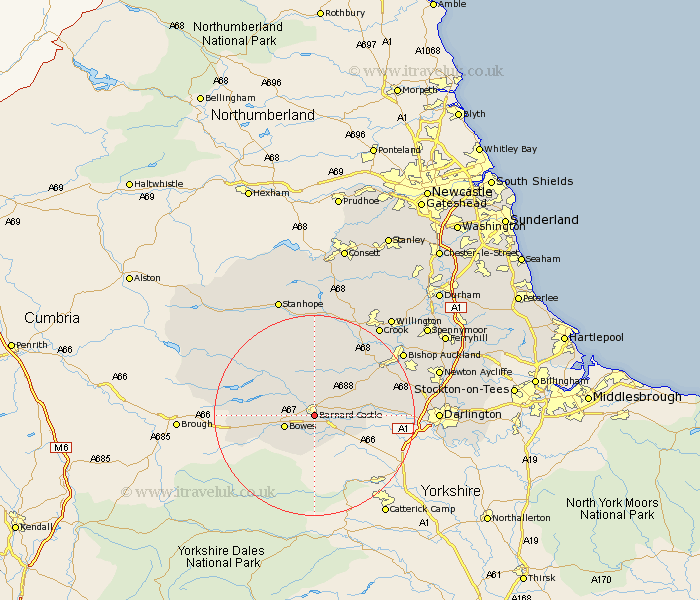
Durham Map Showing Location of Barnard Castle
Population: 6583
Area Size (ha): 210
District: Teesdale
Easting: 405391 Northing: 515353
Latitude: 54.53 Longitude: -1.92
 = Barnard Castle
Area Size (ha): 210
District: Teesdale
Easting: 405391 Northing: 515353
Latitude: 54.53 Longitude: -1.92
= Barnard Castle
This Barnard Castle map below is supplied by Google. Use the tools in the top left corner to zoom into street level or zoom out for a road map, you may also need to zoom in to see Barnard Castle on the map. Click and drag the map to move around. If the map fails to load try and refresh your browser or zoom in or out (+ or -).
Update - it seems Google no longer allow people to use their maps for free! This Barnard Castle map sometimes loads and sometimes gives a error. I am working on a solution.
Closest 30 Towns or Cities to Barnard Castle (Population over 500)
Cotherstone 5.68km Staindrop 8.39km Cockfield 11.94km Gainford 11.97km Evenwood 13.4km Middleton in Teesdale 14.19km West Auckland 16.23km Etherley 16.84km High Etherley 16.84km Shildon 20.47km Wolsingham 20.51km Bishop Auckland 20.68km Crook 21.98km Darlington 22.58km Coundon 22.69km Tow Law 23.15km Newton Aycliffe 24.39km Willington 24.71km Stanhope 24.94km Hurworth 26.41km Spennymoor 27.5km Ferryhill 28.91km Cornsay 29.42km Brandon 30.87km Esh 31.1km West Cornforth 31.73km Cornforth 31.73km Stillington 32.03km Bishop Middleham 32.51km Ushaw Moor 32.67km