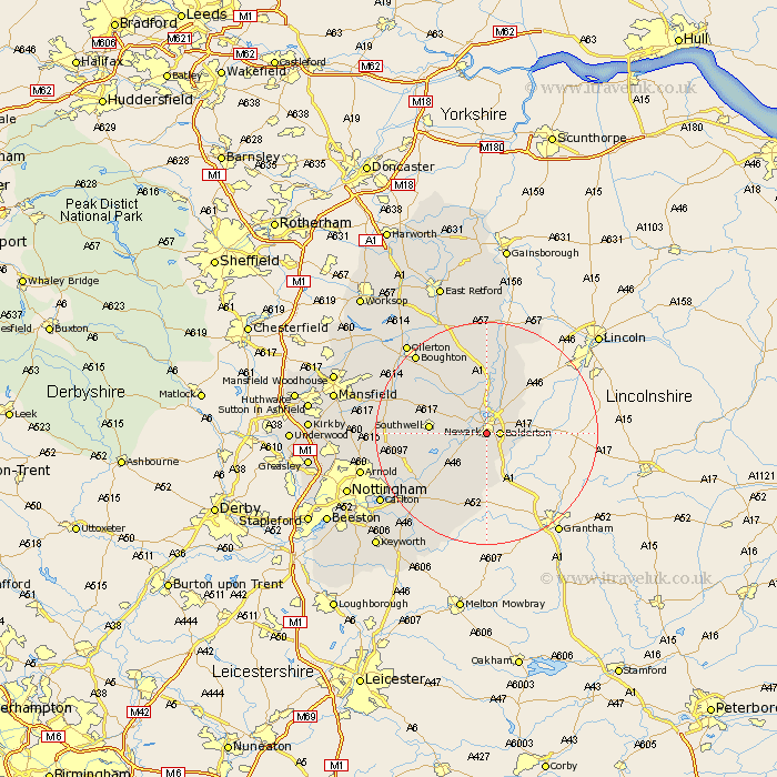
Nottinghamshire Map Showing Location of Newark On Trent
Population: 34528
Area Size (ha): 851
District: Newark and Sherwood
Easting: 479282 Northing: 352846
Latitude: 53.07 Longitude: -0.82
 = Newark On Trent
Area Size (ha): 851
District: Newark and Sherwood
Easting: 479282 Northing: 352846
Latitude: 53.07 Longitude: -0.82
= Newark On Trent
This Newark On Trent map below is supplied by Google. Use the tools in the top left corner to zoom into street level or zoom out for a road map, you may also need to zoom in to see Newark On Trent on the map. Click and drag the map to move around. If the map fails to load try and refresh your browser or zoom in or out (+ or -).
Update - it seems Google no longer allow people to use their maps for free! This Newark On Trent map sometimes loads and sometimes gives a error. I am working on a solution.
Closest 30 Towns or Cities to Newark On Trent (Population over 500)
Balderton 2.23km Farndon 2.9km Winthorpe 4.32km Coddington 4.82km Muskham 5.56km North Muskham 5.56km Fiskerton Ferry 5.87km Fiskerton 5.87km Elston 6.48km Bleasby 8.64km Southwell 9.68km Collingham 10.28km North Collingham 10.28km Flintham 10.82km East Bridgford 14.25km Farnsfield 14.94km Aslocton 15.49km Aslockton 15.49km Bilsthorpe 16.25km Oxton 16.81km Burton Joyce 17.2km Tuxford 17.26km Bingham 17.31km Shelford 17.39km Woodborough 17.61km Claverton 18.21km Calverton 18.21km Boughton 18.94km Lambley 19.12km Barnstone 19.35km