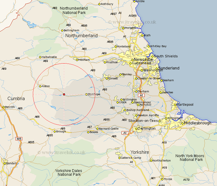
Durham Map Showing Location of Wear Head
District: Wear Valley
Easting: 386055 Northing: 539482
Latitude: 54.75 Longitude: -2.22
 = Wear Head
Easting: 386055 Northing: 539482
Latitude: 54.75 Longitude: -2.22
= Wear Head
This Wear Head map below is supplied by Google. Use the tools in the top left corner to zoom into street level or zoom out for a road map, you may also need to zoom in to see Wear Head on the map. Click and drag the map to move around. If the map fails to load try and refresh your browser or zoom in or out (+ or -).
Update - it seems Google no longer allow people to use their maps for free! This Wear Head map sometimes loads and sometimes gives a error. I am working on a solution.
Closest 30 Towns or Cities to Wear Head (Population over 500)
Stanhope 12.84km Middleton in Teesdale 17.12km Wolsingham 21.72km Castleside 24.27km Cotherstone 25.31km Tow Law 25.74km Consetti 26.97km Consett 26.97km Cornsay 29.1km Leadgate 29.69km Cockfield 30.61km Startforth 30.87km Barnard Castle 30.87km Crook 31.53km Lanchester 31.87km High Etherley 31.98km Etherley 31.98km Evenwood 32.5km Annfield Plain 32.92km Esh 33.35km Willington 33.38km West Auckland 33.66km Staindrop 33.67km Stanley 35.3km Langley Park 35.71km Rowlands Gill 36.08km Burnopfield 36.11km Ushaw Moor 36.54km Bishop Auckland 37.05km Coundon 37.56km