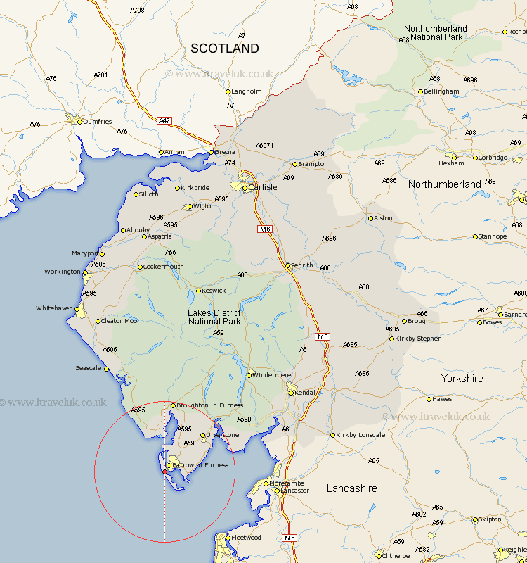
Cumbria Map Showing Location of Vickerstown
District: Barrow-in-Furness
Easting: 318269 Northing: 467865
Latitude: 54.1 Longitude: -3.25
 = Vickerstown
Easting: 318269 Northing: 467865
Latitude: 54.1 Longitude: -3.25
= Vickerstown
This Vickerstown map below is supplied by Google. Use the tools in the top left corner to zoom into street level or zoom out for a road map, you may also need to zoom in to see Vickerstown on the map. Click and drag the map to move around. If the map fails to load try and refresh your browser or zoom in or out (+ or -).
Update - it seems Google no longer allow people to use their maps for free! This Vickerstown map sometimes loads and sometimes gives a error. I am working on a solution.
Closest 30 Towns or Cities to Vickerstown (Population over 500)
Isle of Walney 2.15km Dalton 7.77km Dalton in Furness 7.77km Askam 9.51km Askam in Furness 9.51km Lindal in Furness 9.87km Lindal 9.87km Aldingham 9.95km Great Urswick 10.31km Millom 11.17km Pennington 11.98km Ulverston 14.8km Ulverstone 14.8km Bootle 20.03km Holker 20.65km Lower Holker 20.65km Haverthwaite 21.22km Colton 22.65km Arnside 28.68km Coniston 31.96km Conistan 31.96km Beetham 33.38km Hawkshead 33.81km Milnthorpe 34.04km Levens 34.65km Heversham 34.78km Seascale 34.96km Gosforth 35.42km Holme 35.95km Windermere 36.72km