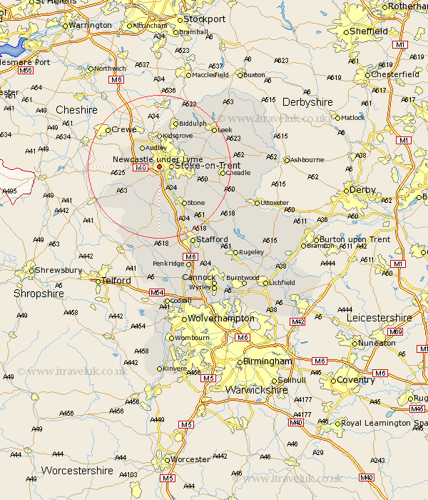
Staffordshire Map Showing Location of Newcastle Under Lyme
Population: 72312
Area Size (ha): 1860
District: Newcastle-under-Lyme
Easting: 384342 Northing: 344801
Latitude: 53 Longitude: -2.23
 = Newcastle Under Lyme
Area Size (ha): 1860
District: Newcastle-under-Lyme
Easting: 384342 Northing: 344801
Latitude: 53 Longitude: -2.23
= Newcastle Under Lyme
This Newcastle Under Lyme map below is supplied by Google. Use the tools in the top left corner to zoom into street level or zoom out for a road map, you may also need to zoom in to see Newcastle Under Lyme on the map. Click and drag the map to move around. If the map fails to load try and refresh your browser or zoom in or out (+ or -).
Update - it seems Google no longer allow people to use their maps for free! This Newcastle Under Lyme map sometimes loads and sometimes gives a error. I am working on a solution.
Closest 30 Towns or Cities to Newcastle Under Lyme (Population over 500)
Stoke upon Trent 3.35km Stoke 3.35km Stoke-upon-Trent 3.35km Stoke on Trent 3.35km Stoke-on-Trent 3.35km Keele 3.35km Silverdale 3.83km Whitmore 4.99km Madeley 6.69km Audley 7.13km Barlaston 7.13km Kidsgrove 9.26km Swinnerton 9.33km Swynnerton 9.33km Betley 9.66km Standon 9.85km Caverswall 11.31km Endon 12.11km Fulford 12.47km Stone 12.98km Hilderstone 13.67km Biddulph 13.72km Draycott 13.89km Draycott in the Moors 13.89km Cheddleton 14.49km Horton 16.4km Eccleshall 16.72km Kingsley 16.83km Cheadle 16.84km Ipstones 18.22km