Northumberland Map Showing Location of Slaggyford
District: Tynedale
Easting: 367899 Northing: 550701
Latitude: 54.85 Longitude: -2.5
 = Slaggyford
Easting: 367899 Northing: 550701
Latitude: 54.85 Longitude: -2.5
= Slaggyford
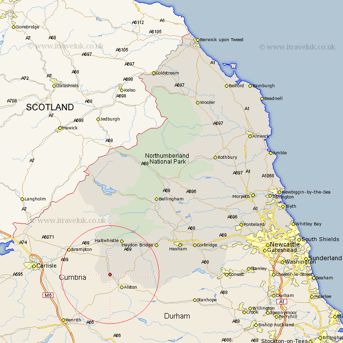
This Slaggyford map below is supplied by Google. Use the tools in the top left corner to zoom into street level or zoom out for a road map, you may also need to zoom in to see Slaggyford on the map. Click and drag the map to move around. If the map fails to load try and refresh your browser or zoom in or out (+ or -).
Update - it seems Google no longer allow people to use their maps for free! This Slaggyford map sometimes loads and sometimes gives a error. I am working on a solution.
Closest 30 Towns or Cities to Slaggyford (Population over 500)
Haltwhistle 15.42km Haydon Bridge 21.42km Newbrough 26.22km Warden 27.73km Hexham 28.67km Acomb 29.55km Wark 30.13km Slaley 30.37km Humshaugh 31.05km Sandhoe 32.36km Chollerton 32.68km Challerton 32.68km Corbridge 33.51km Ridingmill 35.34km Riding 35.34km Bellingham 37.45km Stocksfield 38.44km Ovingham 42.51km Prudhoe 43.02km Wylam 43.53km Stamfordham 45.3km Otterburn 45.98km Newburn 50.7km Ponteland 52.8km Woolsington 55.37km Dinnington 56.69km Gosforth 58.86km Newcastle-on-Tyne 58.98km Newcastle on Tyne 58.98km Newcastle upon Tyne 58.98km