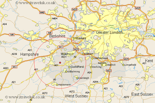
Surrey Map Showing Location of Normandy
Population: 2987
District: Guildford
Easting: 493045 Northing: 150993
Latitude: 51.25 Longitude: -0.67
 = Normandy
District: Guildford
Easting: 493045 Northing: 150993
Latitude: 51.25 Longitude: -0.67
= Normandy
This Normandy map below is supplied by Google. Use the tools in the top left corner to zoom into street level or zoom out for a road map, you may also need to zoom in to see Normandy on the map. Click and drag the map to move around. If the map fails to load try and refresh your browser or zoom in or out (+ or -).
Update - it seems Google no longer allow people to use their maps for free! This Normandy map sometimes loads and sometimes gives a error. I am working on a solution.
Closest 30 Towns or Cities to Normandy (Population over 500)
Pirbright 4.37km Puttenham 5.56km Worplesdon 5.93km Tongham 5.94km Compton 6.02km Deepcut 6.56km Seale 6.56km Frimley 7.24km Guilford 7.89km Guildford 7.89km Goldaming 8.75km Godalming 8.75km Shalford 8.91km Bisley 9.55km Milford 9.55km Elstead 9.55km Send 9.99km Chobham 10.36km Farnham 10.82km Bramley 11km Chilworth 11.08km St. Martha 11.08km St Martha 11.08km Saint Martha 11.08km West Clandon 11.6km Woking 11.87km Wonersh 11.88km Camberley 12.05km Camberly 12.05km Bagshot 13.03km