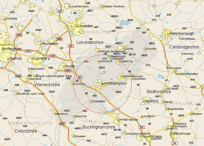
Northamptonshire Map Showing Location of Northampton
Population: 177687
Area Size (ha): 4640
District: Northampton
Easting: 476223 Northing: 261944
Latitude: 52.25 Longitude: -0.88
 = Northampton
Area Size (ha): 4640
District: Northampton
Easting: 476223 Northing: 261944
Latitude: 52.25 Longitude: -0.88
= Northampton
This Northampton map below is supplied by Google. Use the tools in the top left corner to zoom into street level or zoom out for a road map, you may also need to zoom in to see Northampton on the map. Click and drag the map to move around. If the map fails to load try and refresh your browser or zoom in or out (+ or -).
Update - it seems Google no longer allow people to use their maps for free! This Northampton map sometimes loads and sometimes gives a error. I am working on a solution.
Closest 30 Towns or Cities to Northampton (Population over 500)
Boughton 3.87km Moulton 4.34km Great Billing 4.54km Billing 4.54km Great Houghton 5.03km Houghton 5.03km Hardingstone 5.56km Pitsford 5.56km Overstone 5.86km Kislingbury 6.78km Harpole 7.06km Wootton 7.42km Collingtree 7.5km Brixworth 7.5km Sywell 7.75km Milton 7.76km Spratton 8.69km Hackleton 8.7km Earls Barton 9.08km Whiston 9.27km Denton 9.7km Blisworth 9.87km Walgrave 10.32km East Haddon 10.64km Bugbrooke 10.65km Gayton 10.86km Roade 11.12km Wilby 11.49km Flore 11.5km Yardley Hastings 11.63km