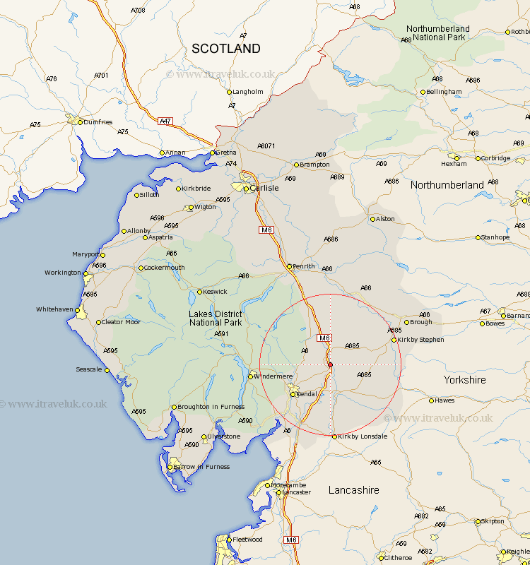
Cumbria Map Showing Location of Low Borrowbridge
District: South Lakeland
Easting: 361052 Northing: 500685
Latitude: 54.4 Longitude: -2.6
 = Low Borrowbridge
Easting: 361052 Northing: 500685
Latitude: 54.4 Longitude: -2.6
= Low Borrowbridge
This Low Borrowbridge map below is supplied by Google. Use the tools in the top left corner to zoom into street level or zoom out for a road map, you may also need to zoom in to see Low Borrowbridge on the map. Click and drag the map to move around. If the map fails to load try and refresh your browser or zoom in or out (+ or -).
Update - it seems Google no longer allow people to use their maps for free! This Low Borrowbridge map sometimes loads and sometimes gives a error. I am working on a solution.
Closest 30 Towns or Cities to Low Borrowbridge (Population over 500)
Tebay 2.15km Orton 7.72km Milnthorpe 10.72km Millthrop 10.72km Sedbergh 10.72km Ravenstonedale 12.01km Crosby Ravensworth 13.02km Kendal 13.43km Kendall 13.43km Shap 13.67km Staveley 14.51km Natland 15.59km Dent 17.73km Kirkby Stephen 17.79km Appleby 20.01km Levens 20.48km Windermere 20.84km Heversham 21.46km Kirkby Londsdale 22.27km Kirkby Lonsdale 22.27km Long Marston 22.88km Long Marton 22.88km Milnthorpe 23.08km Brough 23.33km Ambleside 23.8km Kirkby Thore 24.31km Beetham 24.73km Holme 25.26km Hawkshead 26.17km Culgaith 27.8km