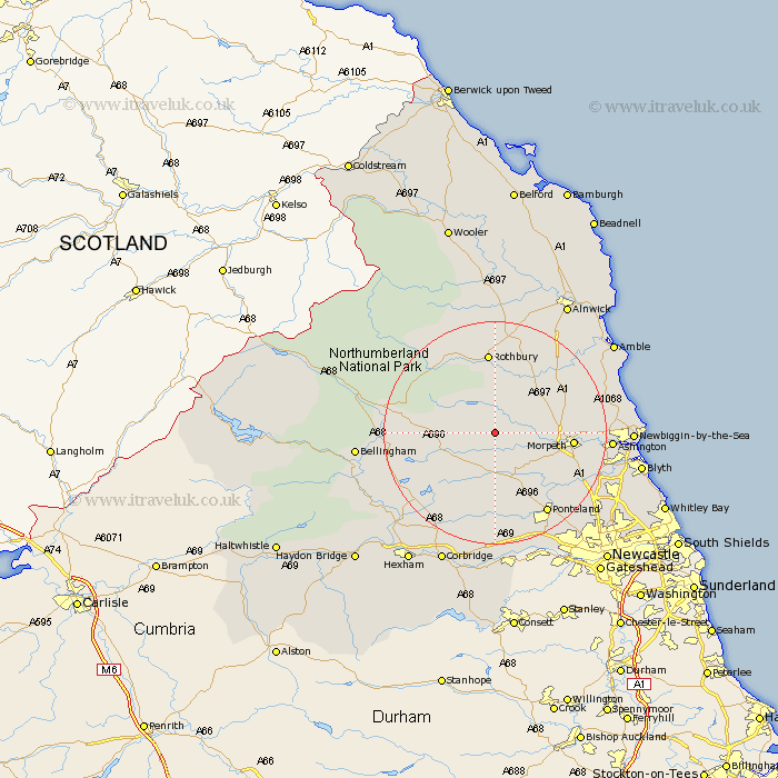
Northumberland Map Showing Location of Longwitton
District: Castle Morpeth
Easting: 407428 Northing: 587679
Latitude: 55.18 Longitude: -1.88
 = Longwitton
Easting: 407428 Northing: 587679
Latitude: 55.18 Longitude: -1.88
= Longwitton
This Longwitton map below is supplied by Google. Use the tools in the top left corner to zoom into street level or zoom out for a road map, you may also need to zoom in to see Longwitton on the map. Click and drag the map to move around. If the map fails to load try and refresh your browser or zoom in or out (+ or -).
Update - it seems Google no longer allow people to use their maps for free! This Longwitton map sometimes loads and sometimes gives a error. I am working on a solution.
Closest 30 Towns or Cities to Longwitton (Population over 500)
Longhorsley 9.26km Hebron 12.7km Longframlington 12.8km Morpeth 12.83km Rothbury 14.87km Hepscott 15.28km Pegswood 15.98km Felton 16.09km Swarland 16.09km Stannington 16.59km Stamfordham 16.71km Thirston 16.87km East Thirston 16.87km Ponteland 17.08km Otterburn 18.36km Ashington 18.98km Dinnington 19.53km Bedlington 19.74km Ellington 20.44km Challerton 21.64km Chollerton 21.64km Lynemouth 21.88km Dudley 21.89km East Chevington 22.03km Newbiggin-by-the-Sea 22.25km Newbiggin by the Sea 22.25km Woolsington 22.47km Bellingham 22.54km Humshaugh 23.04km Cramlington 23.06km