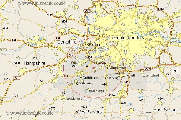
Surrey Map Showing Location of Ockham
Population: 384
District: Guildford
Easting: 508085 Northing: 154996
Latitude: 51.28 Longitude: -0.45
 = Ockham
District: Guildford
Easting: 508085 Northing: 154996
Latitude: 51.28 Longitude: -0.45
= Ockham
This Ockham map below is supplied by Google. Use the tools in the top left corner to zoom into street level or zoom out for a road map, you may also need to zoom in to see Ockham on the map. Click and drag the map to move around. If the map fails to load try and refresh your browser or zoom in or out (+ or -).
Update - it seems Google no longer allow people to use their maps for free! This Ockham map sometimes loads and sometimes gives a error. I am working on a solution.
Closest 30 Towns or Cities to Ockham (Population over 500)
West Horsley 1.85km Ripley 2.32km Horsley 3.88km East Horsley 3.88km Church Cobham 4.37km Cobham 4.37km West Clandon 5.08km Effingham 5.08km Byfleet 5.68km Send 5.8km Woking 6.88km Oxshott 7.88km Chilworth 8.74km St. Martha 8.74km St Martha 8.74km Saint Martha 8.74km Leatherhead 9.27km Shere 9.34km Weybridge 9.34km Ottershaw 9.41km Esher 9.41km Albury 9.55km Addlestone 9.55km Mickleham 9.99km Claygate 10.16km Westcott 10.17km Wotton 10.36km Worplesdon 10.43km Guildford 10.99km Guilford 10.99km