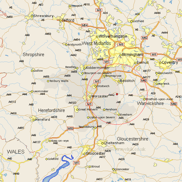
Worcestershire Map Showing Location of Holberrow Green
District: Wychavon
Easting: 403415 Northing: 257655
Latitude: 52.22 Longitude: -1.95
 = Holberrow Green
Easting: 403415 Northing: 257655
Latitude: 52.22 Longitude: -1.95
= Holberrow Green
This Holberrow Green map below is supplied by Google. Use the tools in the top left corner to zoom into street level or zoom out for a road map, you may also need to zoom in to see Holberrow Green on the map. Click and drag the map to move around. If the map fails to load try and refresh your browser or zoom in or out (+ or -).
Update - it seems Google no longer allow people to use their maps for free! This Holberrow Green map sometimes loads and sometimes gives a error. I am working on a solution.
Closest 30 Towns or Cities to Holberrow Green (Population over 500)
Inkberrow 2.18km Astwood Bank 3.87km Feckenham 4.34km Bishampton 7.18km Church Lench 7.42km Hanbury 8.79km Radditch 9.33km Redditch 9.33km Harvington 9.55km Cleeve Prior 10.88km Crowle 11.51km Beoley 11.63km Fladbury 12.01km Stoke Prior 12.2km Peopleton 12.63km Alvechurch 12.97km Charlton 13.17km Offenham 13.17km Pershore 13.67km South Littleton 13.75km Littleton 13.75km Droitwich 14.71km Evesham 14.88km Barnt Green 14.99km Pebworth 15.11km Bromsgrove 15.2km Cropthorne 15.22km Badsey 15.52km Honeybourne 16.83km Cow Honeybourne 16.83km