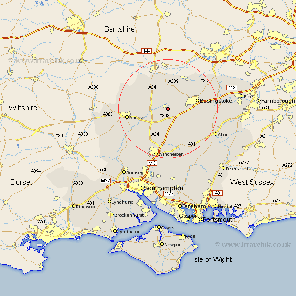
Hampshire Map Showing Location of Overton
Population: 3548
Area Size (ha): 84
District: Basingstoke and Deane
Easting: 452357 Northing: 148559
Latitude: 51.23 Longitude: -1.25
 = Overton
Area Size (ha): 84
District: Basingstoke and Deane
Easting: 452357 Northing: 148559
Latitude: 51.23 Longitude: -1.25
= Overton
This Overton map below is supplied by Google. Use the tools in the top left corner to zoom into street level or zoom out for a road map, you may also need to zoom in to see Overton on the map. Click and drag the map to move around. If the map fails to load try and refresh your browser or zoom in or out (+ or -).
Update - it seems Google no longer allow people to use their maps for free! This Overton map sometimes loads and sometimes gives a error. I am working on a solution.
Closest 30 Towns or Cities to Overton (Population over 500)
Oakley 5km North Waltham 5.94km Whitchurch 6.09km Dummer 7.89km Kingsclere 9.27km Wonston 10.36km Burghclere 10.37km Barton Stacey 11km Micheldever 11.18km Ecchinswell 11.18km Longparish 11.84km Basingstoke 12.18km Baughurst 12.54km Highclere 12.54km Hurstbourne Tarrant 14.41km Tadley 15.3km Basing 15.53km Bramley 15.77km Chilbolton 15.78km Andover 16.67km Kings Worthy 17.04km Upper Clatford 17.18km East Woodhay 17.4km Upton Grey 17.51km New Alresford 17.66km Sherfield upon Loddon 17.85km Sherfield 17.85km Goodworth Clatford 17.86km Clatford 17.86km Lower Clatford 17.86km