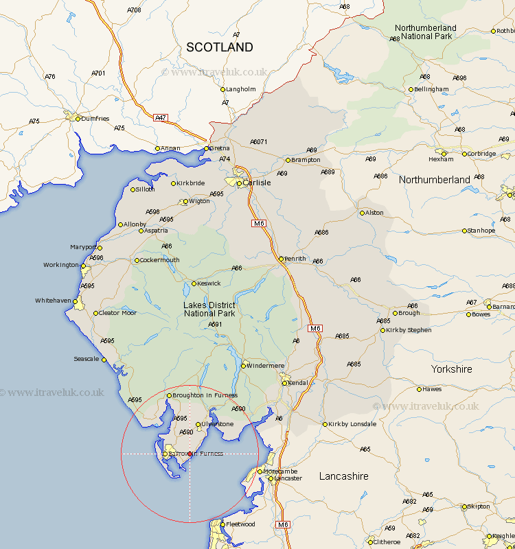
Cumbria Map Showing Location of Glaston
District: South Lakeland
Easting: 325927 Northing: 469594
Latitude: 54.12 Longitude: -3.13
 = Glaston
Easting: 325927 Northing: 469594
Latitude: 54.12 Longitude: -3.13
= Glaston
This Glaston map below is supplied by Google. Use the tools in the top left corner to zoom into street level or zoom out for a road map, you may also need to zoom in to see Glaston on the map. Click and drag the map to move around. If the map fails to load try and refresh your browser or zoom in or out (+ or -).
Update - it seems Google no longer allow people to use their maps for free! This Glaston map sometimes loads and sometimes gives a error. I am working on a solution.
Closest 30 Towns or Cities to Glaston (Population over 500)
Aldingham 2.17km Great Urswick 3.86km Dalton in Furness 4.29km Dalton 4.29km Lindal 5.67km Lindal in Furness 5.67km Pennington 7.41km Isle of Walney 7.5km Askam in Furness 9.18km Askam 9.18km Ulverstone 9.51km Ulverston 9.51km Millom 12.7km Holker 13.14km Lower Holker 13.14km Haverthwaite 15.03km Colton 17.54km Arnside 20.89km Bootle 22.55km Beetham 25.61km Milnthorpe 26.33km Heversham 27.16km Levens 27.17km Holme 28.13km Conistan 28.13km Coniston 28.13km Hawkshead 29.12km Windermere 31.16km Natland 31.94km Kendall 33.4km