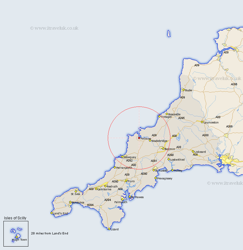
Cornwall Map Showing Location of Padstow
Population: 2497
Area Size (ha): 63
District: North Cornwall
Easting: 192148 Northing: 74566
Latitude: 50.53 Longitude: -4.93
 = Padstow
Area Size (ha): 63
District: North Cornwall
Easting: 192148 Northing: 74566
Latitude: 50.53 Longitude: -4.93
= Padstow
This Padstow map below is supplied by Google. Use the tools in the top left corner to zoom into street level or zoom out for a road map, you may also need to zoom in to see Padstow on the map. Click and drag the map to move around. If the map fails to load try and refresh your browser or zoom in or out (+ or -).
Update - it seems Google no longer allow people to use their maps for free! This Padstow map sometimes loads and sometimes gives a error. I am working on a solution.
Closest 30 Towns or Cities to Padstow (Population over 500)
St Merryn 2.99km Saint Merryn 2.99km St. Merryn 2.99km Saint Issey 3.89km St Issey 3.89km St. Issey 3.89km Wadebridge 7.31km St. Columb Major 11.12km Saint Columb 11.12km St Columb Major 11.12km Saint Columb Major 11.12km St Columb 11.12km St. Columb 11.12km Lanivet 14.99km Roche 16.42km Newquay 16.76km Bodmin 17.02km Saint Denis 17.05km St Dennis 17.05km St Denis 17.05km St. Dennis 17.05km Saint Dennis 17.05km St. Denis 17.05km Blisland 17.77km Stenalees 18.76km Bugle 19.16km Tintagel 19.68km Crantock 19.7km Camelford 19.94km Cardingham 20.79km