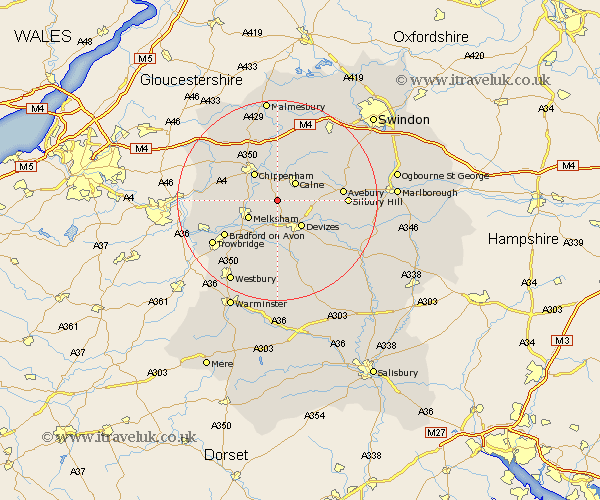
Wiltshire Map Showing Location of Chittoe
District: Kennet
Easting: 396522 Northing: 166830
Latitude: 51.4 Longitude: -2.05
 = Chittoe
Easting: 396522 Northing: 166830
Latitude: 51.4 Longitude: -2.05
= Chittoe
This Chittoe map below is supplied by Google. Use the tools in the top left corner to zoom into street level or zoom out for a road map, you may also need to zoom in to see Chittoe on the map. Click and drag the map to move around. If the map fails to load try and refresh your browser or zoom in or out (+ or -).
Update - it seems Google no longer allow people to use their maps for free! This Chittoe map sometimes loads and sometimes gives a error. I am working on a solution.
Closest 30 Towns or Cities to Chittoe (Population over 500)
Laycock 4.63km Lacock 4.63km Calne 5.07km Bremhill 5.68km Rowde 5.68km Roundway 5.93km Seend 6.02km Melksham 6.87km Cherhill 7.18km Chippenham 7.23km Devizes 7.23km Bishops Cannings 7.87km Semington 8.89km Corsham 8.9km Worton 9.33km Hillmarton 9.4km Hilmarton 9.4km Potterne 9.55km Broughton Gifford 9.97km Atworth 10.57km Whitley 10.65km Christian Malford 11.12km Sutton Benger 11.36km Holt 11.8km Steeple Ashton 12.54km Bradford on Avon 12.78km Bradford-on-Avon 12.78km Erlestoke 13.03km Hilperton 13.1km Urchfont 13.76km