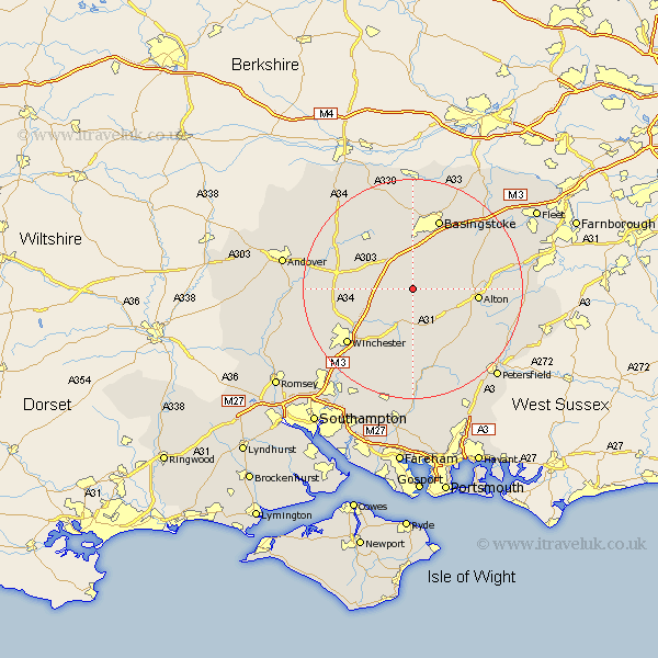
Hampshire Map Showing Location of Chilton Candover
District: Basingstoke and Deane
Easting: 459445 Northing: 139372
Latitude: 51.15 Longitude: -1.15
 = Chilton Candover
Easting: 459445 Northing: 139372
Latitude: 51.15 Longitude: -1.15
= Chilton Candover
This Chilton Candover map below is supplied by Google. Use the tools in the top left corner to zoom into street level or zoom out for a road map, you may also need to zoom in to see Chilton Candover on the map. Click and drag the map to move around. If the map fails to load try and refresh your browser or zoom in or out (+ or -).
Update - it seems Google no longer allow people to use their maps for free! This Chilton Candover map sometimes loads and sometimes gives a error. I am working on a solution.
Closest 30 Towns or Cities to Chilton Candover (Population over 500)
Dummer 5.56km North Waltham 6.03km Medstead 6.89km New Alresford 7.51km Four Marks 7.9km Micheldever 8.35km Ropley 10.37km Cheriton 11.18km Oakley 11.36km Overton 11.59km Wonston 11.63km Alton 11.77km Upton Grey 12.82km Kings Worthy 12.83km Farringdon 12.89km Faringdon 12.89km Upper Farringdon 12.89km Bramdean 13.18km Basingstoke 13.78km Whitchurch 14.77km Barton Stacey 15.22km Basing 15.31km West Meon 15.54km Winchester 15.59km Froyle 16.38km Long Sutton 16.82km Selborne 16.84km Longparish 17.82km Froxfield 18.15km Owslebury 18.56km