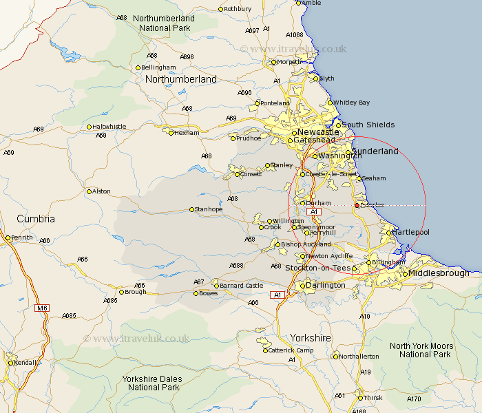
Durham Map Showing Location of Peterlee
Population: 30778
Area Size (ha): 772
District: Easington
Easting: 441981 Northing: 541013
Latitude: 54.76 Longitude: -1.35
 = Peterlee
Area Size (ha): 772
District: Easington
Easting: 441981 Northing: 541013
Latitude: 54.76 Longitude: -1.35
= Peterlee
This Peterlee map below is supplied by Google. Use the tools in the top left corner to zoom into street level or zoom out for a road map, you may also need to zoom in to see Peterlee on the map. Click and drag the map to move around. If the map fails to load try and refresh your browser or zoom in or out (+ or -).
Update - it seems Google no longer allow people to use their maps for free! This Peterlee map sometimes loads and sometimes gives a error. I am working on a solution.
Closest 30 Towns or Cities to Peterlee (Population over 500)
Peterlee 0km Hesleden 2.4km Shotton 2.65km Easington 2.68km Wingate 3.95km Horden 4.34km Haswell 5.02km Hutton Henry 5.06km South Hetton 5.39km Thornley 5.67km Dalton le Dale 6.18km Dalton 6.18km Hart 7.25km Murton 7.51km Trimdon 8.22km Seaton 8.23km Seaham Harbour 8.31km Seaham 8.31km Sherburn 8.73km Hetton le Hole 8.94km Pittington 9.67km Elwick 9.69km Fishburn 10.36km Coxhoe 11.02km Bowburn 11.32km West Rainton 11.5km Shincliffe 11.93km Hartlepool 12.15km Bishop Middleham 12.37km Houghton le Spring 12.39km