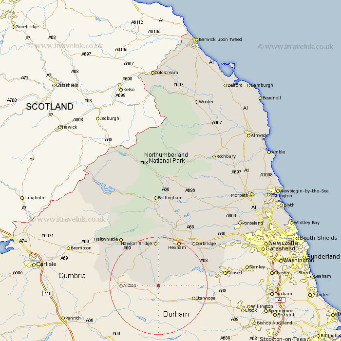
Northumberland Map Showing Location of Allenheads
District: Tynedale
Easting: 386072 Northing: 545045
Latitude: 54.8 Longitude: -2.22
 = Allenheads
Easting: 386072 Northing: 545045
Latitude: 54.8 Longitude: -2.22
= Allenheads
This Allenheads map below is supplied by Google. Use the tools in the top left corner to zoom into street level or zoom out for a road map, you may also need to zoom in to see Allenheads on the map. Click and drag the map to move around. If the map fails to load try and refresh your browser or zoom in or out (+ or -).
Update - it seems Google no longer allow people to use their maps for free! This Allenheads map sometimes loads and sometimes gives a error. I am working on a solution.
Closest 30 Towns or Cities to Allenheads (Population over 500)
Slaley 16.17km Haydon Bridge 18.57km Hexham 19.98km Warden 21.07km Acomb 21.7km Riding 21.81km Ridingmill 21.81km Newbrough 22.34km Corbridge 22.52km Sandhoe 23km Stocksfield 24.25km Haltwhistle 24.65km Humshaugh 26.48km Chollerton 26.99km Challerton 26.99km Prudhoe 28.78km Ovingham 29.07km Wark 29.66km Wylam 29.89km Stamfordham 34.25km Newburn 36.05km Bellingham 38.93km Ponteland 40.77km Woolsington 41.75km Newcastle upon Tyne 43.58km Newcastle-on-Tyne 43.58km Newcastle 43.58km Newcastle on Tyne 43.58km Dinnington 43.98km Gosforth 44.34km