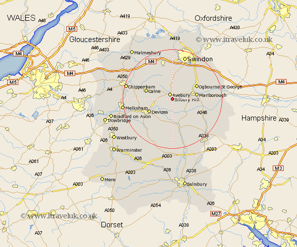
Wiltshire Map Showing Location of Silbury Hill
District: Kennet
Easting: 410252 Northing: 168714
Latitude: 51.4 Longitude: -1.85
 = Silbury Hill
Easting: 410252 Northing: 168714
Latitude: 51.4 Longitude: -1.85
= Silbury Hill
This Silbury Hill map below is supplied by Google. Use the tools in the top left corner to zoom into street level or zoom out for a road map, you may also need to zoom in to see Silbury Hill on the map. Click and drag the map to move around. If the map fails to load try and refresh your browser or zoom in or out (+ or -).
Update - it seems Google no longer allow people to use their maps for free! This Silbury Hill map sometimes loads and sometimes gives a error. I am working on a solution.
Closest 30 Towns or Cities to Silbury Hill (Population over 500)
Cherhill 7.01km Bishops Cannings 7.71km Broad Town 9.31km Broad Hinton 9.36km Marlborough 9.61km Roundway 9.8km Pewsey 10.28km Devizes 10.65km Hilmarton 10.84km Hillmarton 10.84km Calne 10.87km Urchfont 12.45km Upavon 13.21km Bremhill 13.71km Rowde 13.72km Wroughton 13.83km Chiseldon 14.57km Potterne 14.69km Burbage 14.88km Wooton Bassett 15.18km Wootton Bassett 15.18km Lyneham 15.19km Lavington 15.84km Market Lavington 15.84km Grafton 16.93km Seend 16.96km Enford 17.07km Worton 17.52km Christian Malford 17.63km Ramsbury 17.9km