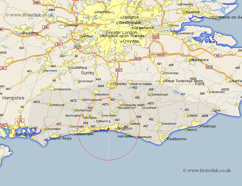
Sussex Map Showing Location of Portslade
Population: 17402
Area Size (ha): 305
Easting: 525567 Northing: 105329
Latitude: 50.83 Longitude: -0.22
 = Portslade
Area Size (ha): 305
Easting: 525567 Northing: 105329
Latitude: 50.83 Longitude: -0.22
= Portslade
This Portslade map below is supplied by Google. Use the tools in the top left corner to zoom into street level or zoom out for a road map, you may also need to zoom in to see Portslade on the map. Click and drag the map to move around. If the map fails to load try and refresh your browser or zoom in or out (+ or -).
Update - it seems Google no longer allow people to use their maps for free! This Portslade map sometimes loads and sometimes gives a error. I am working on a solution.
Closest 30 Towns or Cities to Portslade (Population over 500)
New Shoreham 1.17km Shoreham-by-Sea 1.17km Shoreham by Sea 1.17km Shoreham 1.17km Hove 2.34km Brighton 4.68km Lancing 8.4km North Lancing 8.4km Upper Bleeding 8.95km Upper Beeding 8.95km Bramber 8.95km Steyning 8.96km Sompting 9.55km Henfield 9.91km Hurstpierpoint 9.92km Worthing 10.64km Keymer 10.96km Hassocks 10.96km Albourne 11.37km Saltdean 11.88km Rottingdean 12.28km Ditchelling 12.37km Ditchling 12.37km Plumpton 12.95km Findon 13.01km Kingston 14.17km Kingston near Lewes 14.17km Lewes 14.52km Washington 14.85km Ashington 14.93km