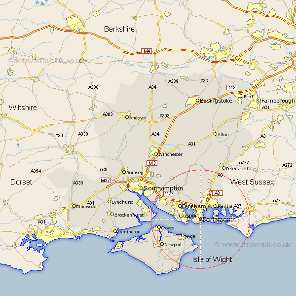
Hampshire Map Showing Location of Portsmouth
Population: 177140
Area Size (ha): 2910
Easting: 464637 Northing: 96809
Latitude: 50.8 Longitude: -1.07
 = Portsmouth
Area Size (ha): 2910
Easting: 464637 Northing: 96809
Latitude: 50.8 Longitude: -1.07
= Portsmouth
This Portsmouth map below is supplied by Google. Use the tools in the top left corner to zoom into street level or zoom out for a road map, you may also need to zoom in to see Portsmouth on the map. Click and drag the map to move around. If the map fails to load try and refresh your browser or zoom in or out (+ or -).
Update - it seems Google no longer allow people to use their maps for free! This Portsmouth map sometimes loads and sometimes gives a error. I am working on a solution.
Closest 30 Towns or Cities to Portsmouth (Population over 500)
Southsea 1.49km Gosport 4.79km Porchester 5.44km Portchester 5.44km Havant 8.26km Waterlooville 8.5km Waterloo 8.5km Southwick 8.58km Seaview 9.22km Lee-on-the-Solent 9.47km Lee on Solent 9.47km Lee-on-Solent 9.47km Lee on the Solent 9.47km Ryde 10.02km Fareham 10.19km Emsworth 11km Saint Helens 11.34km St. Helens 11.34km St Helens 11.34km Rowlands Castle 12.58km Bembridge 12.67km Hambledon 13.34km Wickham 13.51km Brading 13.95km Horndean 14.53km Wootton 14.79km Shedfield 15.71km Shidfield 15.71km Clanfield 15.87km Soberton 15.92km