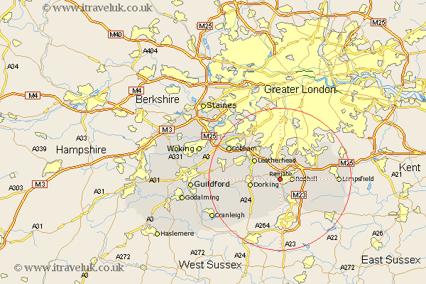
Surrey Map Showing Location of Reigate
Population: 46340
Area Size (ha): 1412
District: Reigate and Banstead
Easting: 524490 Northing: 149802
Latitude: 51.23 Longitude: -0.22
 = Reigate
Area Size (ha): 1412
District: Reigate and Banstead
Easting: 524490 Northing: 149802
Latitude: 51.23 Longitude: -0.22
= Reigate
This Reigate map below is supplied by Google. Use the tools in the top left corner to zoom into street level or zoom out for a road map, you may also need to zoom in to see Reigate on the map. Click and drag the map to move around. If the map fails to load try and refresh your browser or zoom in or out (+ or -).
Update - it seems Google no longer allow people to use their maps for free! This Reigate map sometimes loads and sometimes gives a error. I am working on a solution.
Closest 30 Towns or Cities to Reigate (Population over 500)
Buckland 2.32km Betchworth 2.32km Redhill 3.48km Leigh 3.88km Salfords 5.08km Tadworth 5.68km Nutfield 7.2km Mickleham 7.2km Bletchingley 8.12km Horley 8.18km Dorking 8.33km Leatherhead 8.91km Holmwood 8.91km Charlwood 9.26km Westcott 9.47km Banstead 9.9km Caterham 10km Newdigate 10.36km Godstone 10.44km Wotton 12.18km Tandridge 12.77km Horne 12.81km Effingham 12.9km Whyteleafe 13.11km Oxshott 13.12km Capel 13.12km Warlingham 13.77km Burstow 13.78km Woldingham 13.92km Oxted 13.93km